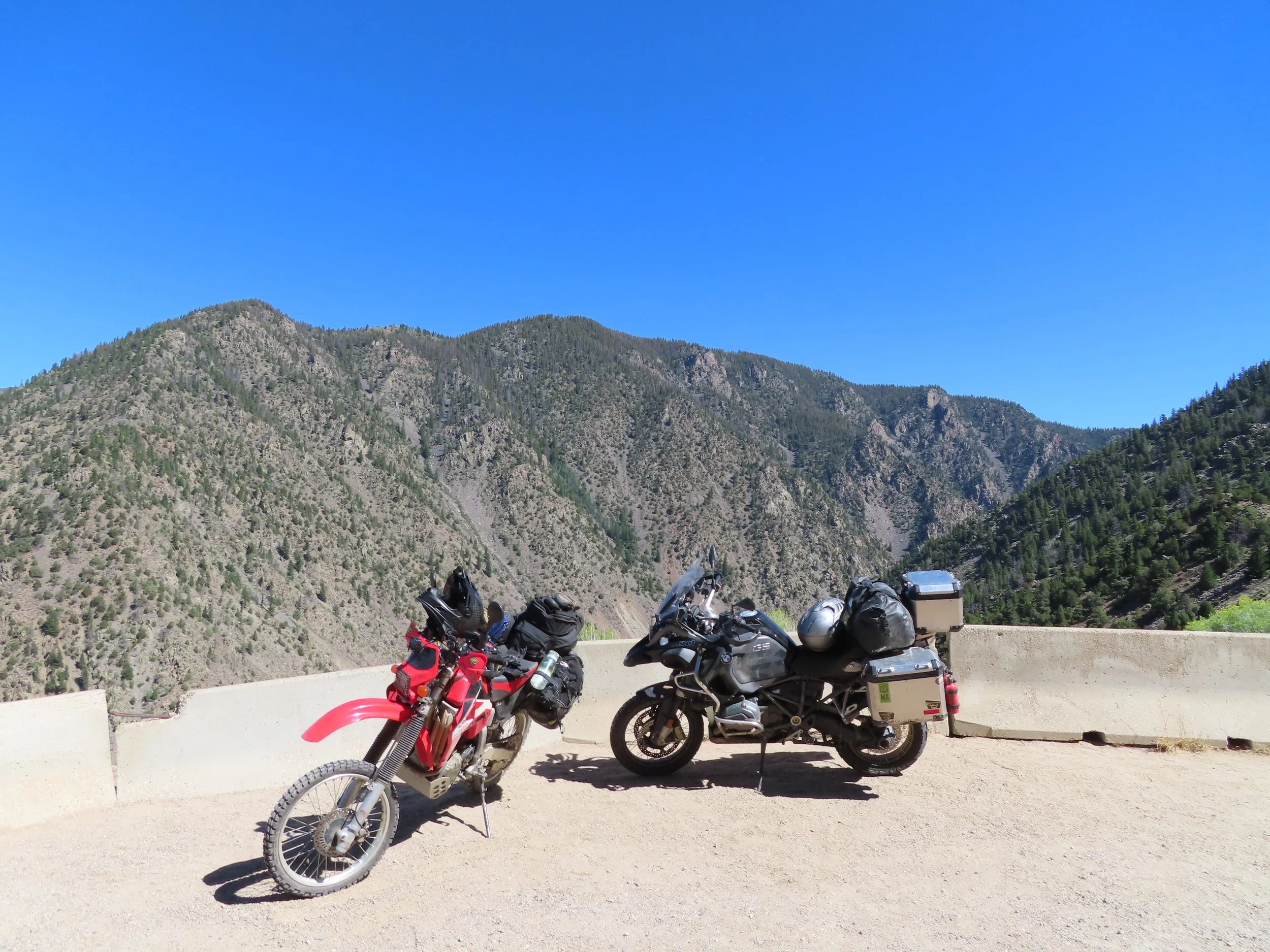
The Great Continental Divide Ride
The Great Continental Divide Ride (GCDR) or Continental Divide Trail (CDT) is roughly a 2,700 mile mostly off-road adventure. Taking you from the Mexico border to the Canada border (Depending on direction of travel) that covers 5 states (New Mexico, Colorado, Wyoming, Idaho and Montana) along the way. Originally the CDT was for hikers. Then joined by bicyclist and mountain bikers. It follows the actual divide closer as sections are closed off to motorized vehicles. Later, adventure Motorcycles made a close route to accommodate riding trails that mixed into the original CDT. it will take about two weeks to ride in its entirety.
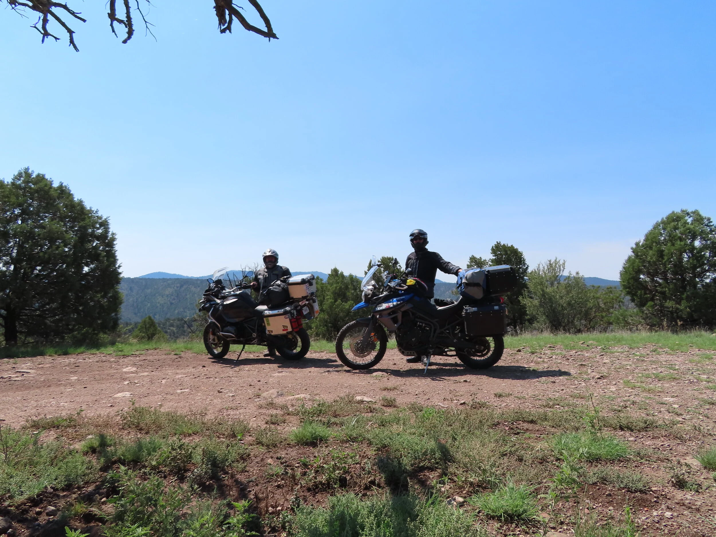
We arrived for the GCDR a couple of days early as our flights were far better priced leaving earlier. I added a few stops to the route that Joined back up to the original plan. Thanks to COVID-19 there were a handful of last minute changes and on-the-fly decisions made along the way. Once we arrived, social distancing was handled on a level of 1000x over easily. 6 feet apart? Pppfftt, maybe 6 miles to the closest human for much of the trip. The “pre” CGDR were named Day 00 and Day 0 to keep the GPX files easy to maintain order.
Day 0
Pick up bikes
White Sands
Alamogordo
Stats:
Miles: 60 by car / 80 on Bike
Ride time: 3:50
Avg Speed: 46.8
Temp: 90° - 97°
Altitude: 3,675 min – 5,678 max
Notes:
Lodging – Day’s inn
Ride –
· First lesson learned! Arrival/Pickup bikes/ Repack and sort rental car takes far more time than budgeted. Late start = bumping plans. COVID in the mix and the New Mexico Governor had every park, campsite and BLM closed. Original plan of camping at the Three Rivers Petroglyph site was cancelled.
· Heavy rains and gale force winds slowed us up a bit.
· Another original plan that was scrubbed was the White Sands Missile Range Musuem (this COVID thing is really beginning to suck).
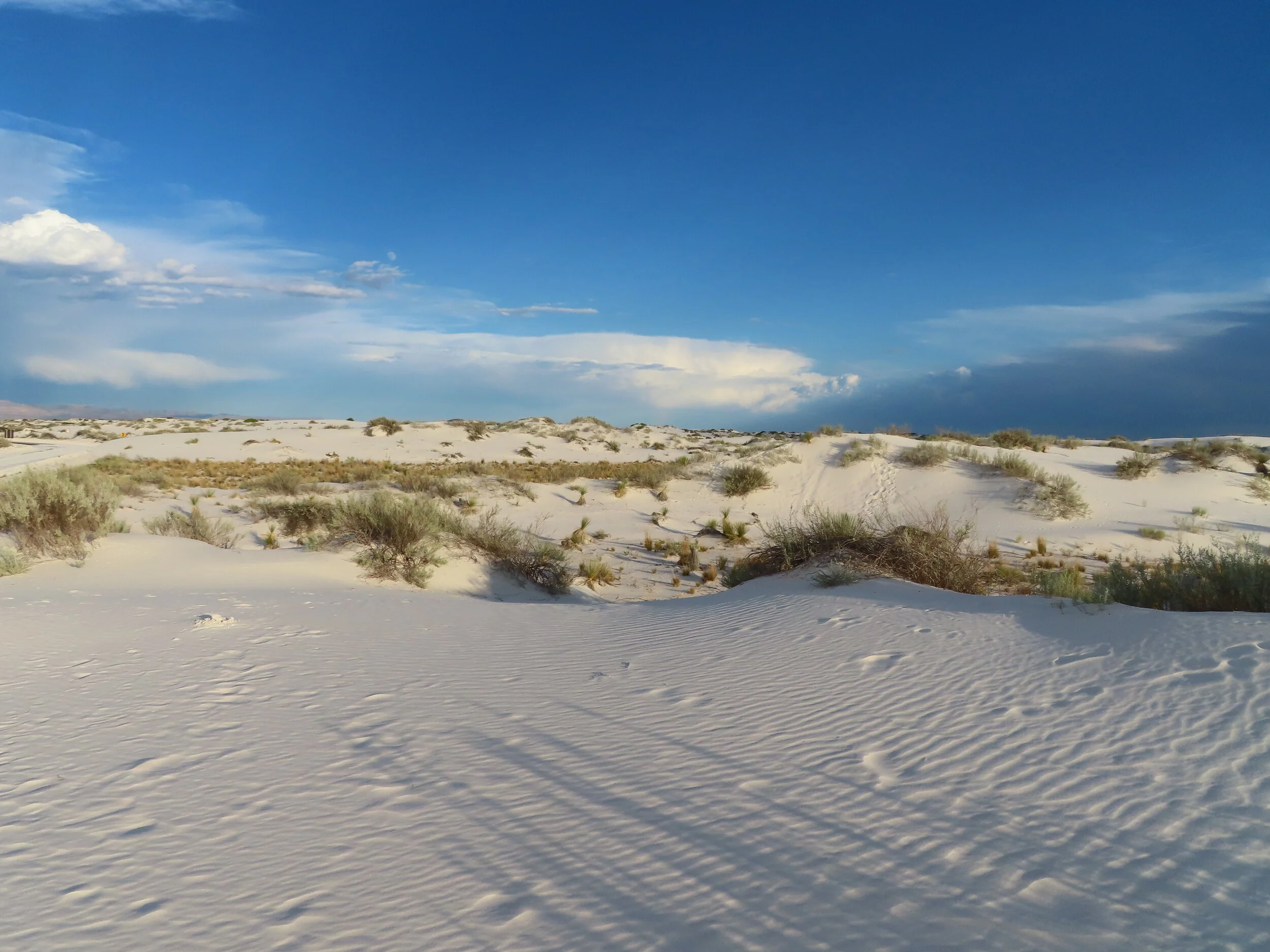
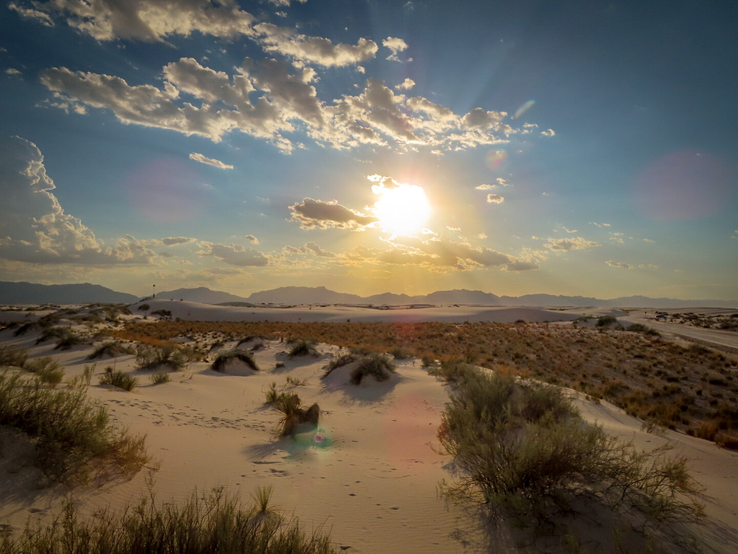
· White Sands Nat’l Park was really cool. Bit of high winds and rain along the way but didn’t get that wet. Winds were horrendous.
· Alternately planned to camp at Valley of fire Campground was also scrubbed as we rolled into Alamogordo the sun was setting with heavy storm brewing.
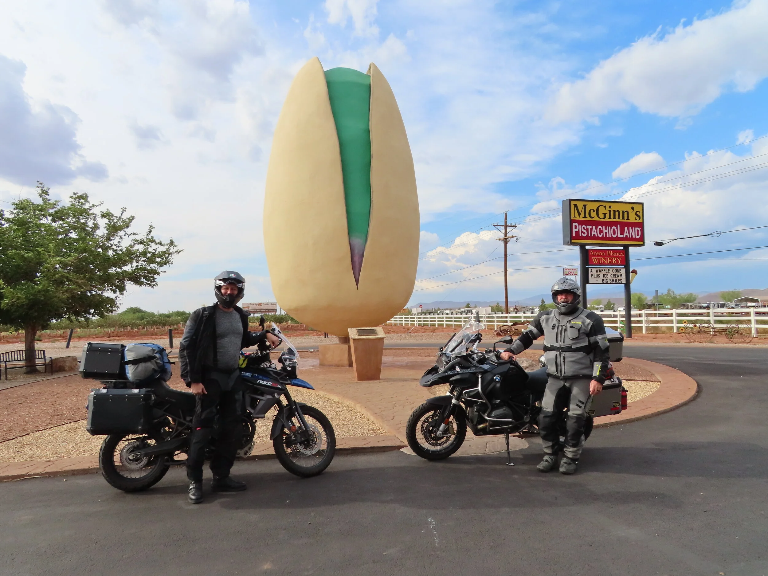
· Heading to the hotel for the night we fount thr worlds largest pistachio!
· Dinner was the BEST tamales EVER!! From a grocery store to boot! “Lowes” beer / wine / food store. They had a tortilleria shop inside.
Day 00
Petroglyph Site
Valley of Fire State Park
Alien Loop
El Paso
Stats:
Miles: 346
Ride time: 8:56
Avg Speed: 49.8
Temp: 57° - 102°
Altitude: 3,722 min – 7,455 max
Notes:
Lodging – AirBNB
Ride –
· Great start, bikes were packed, hotel breakfast completed and we were rolling by 8:00
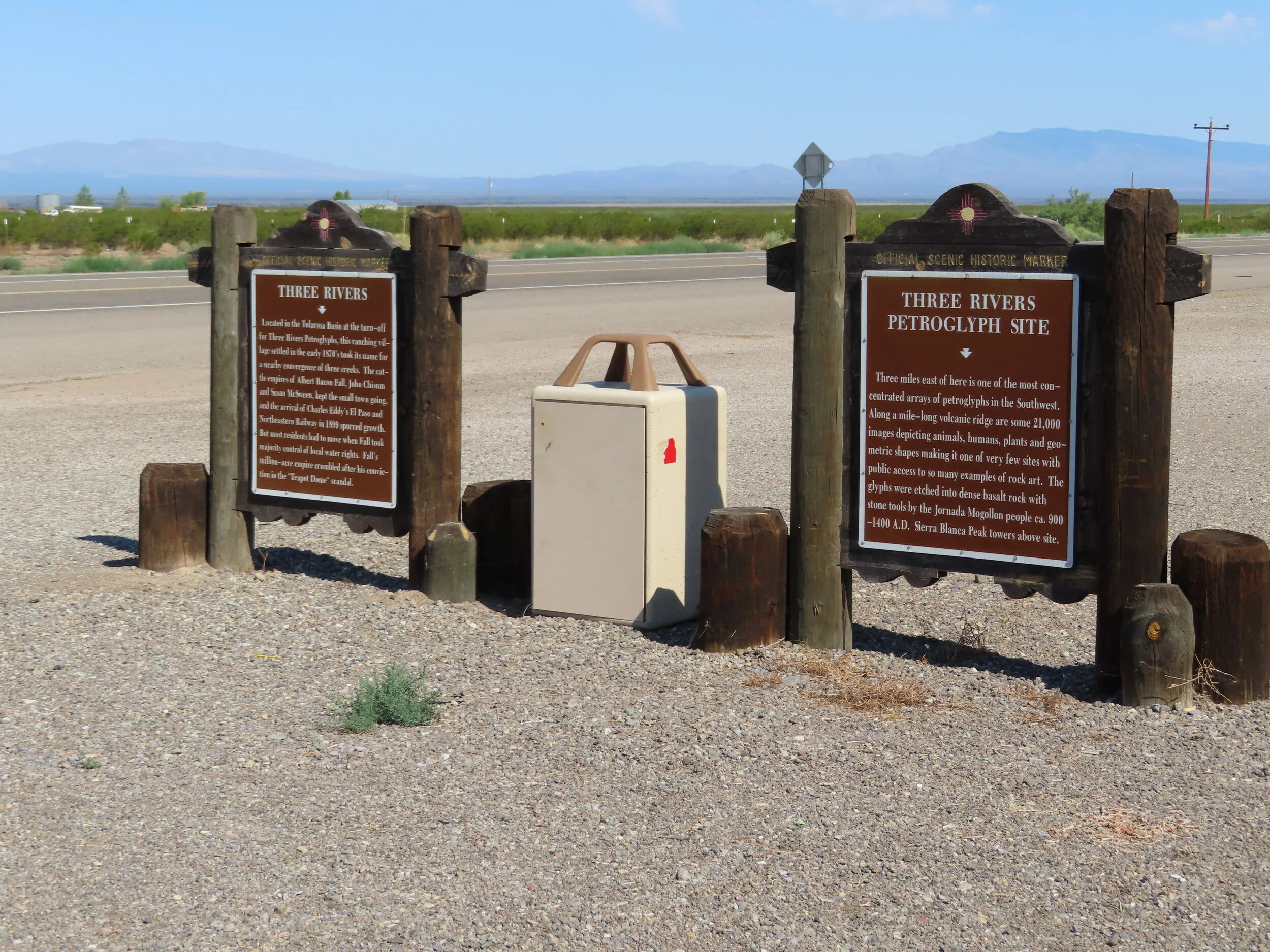
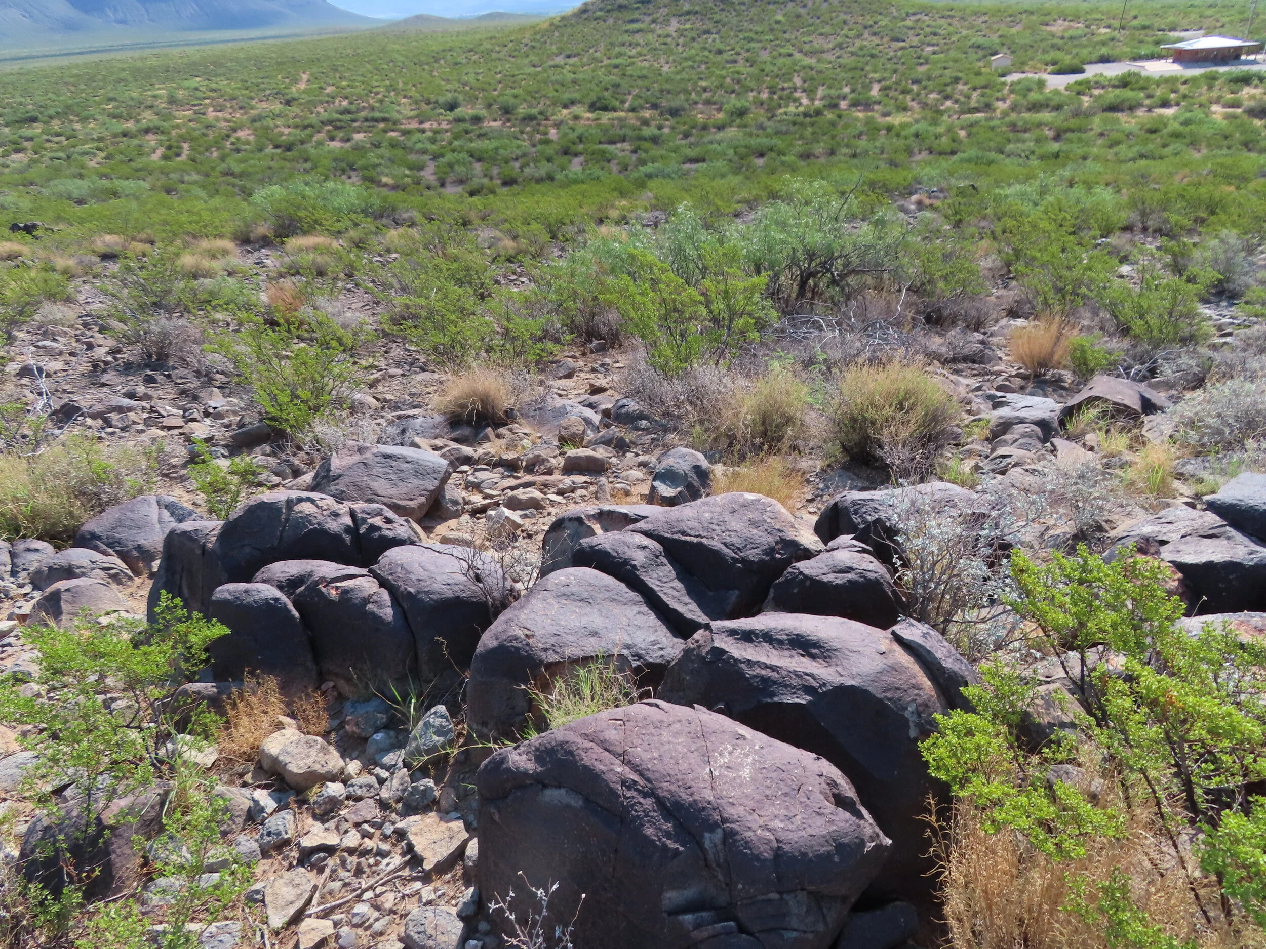
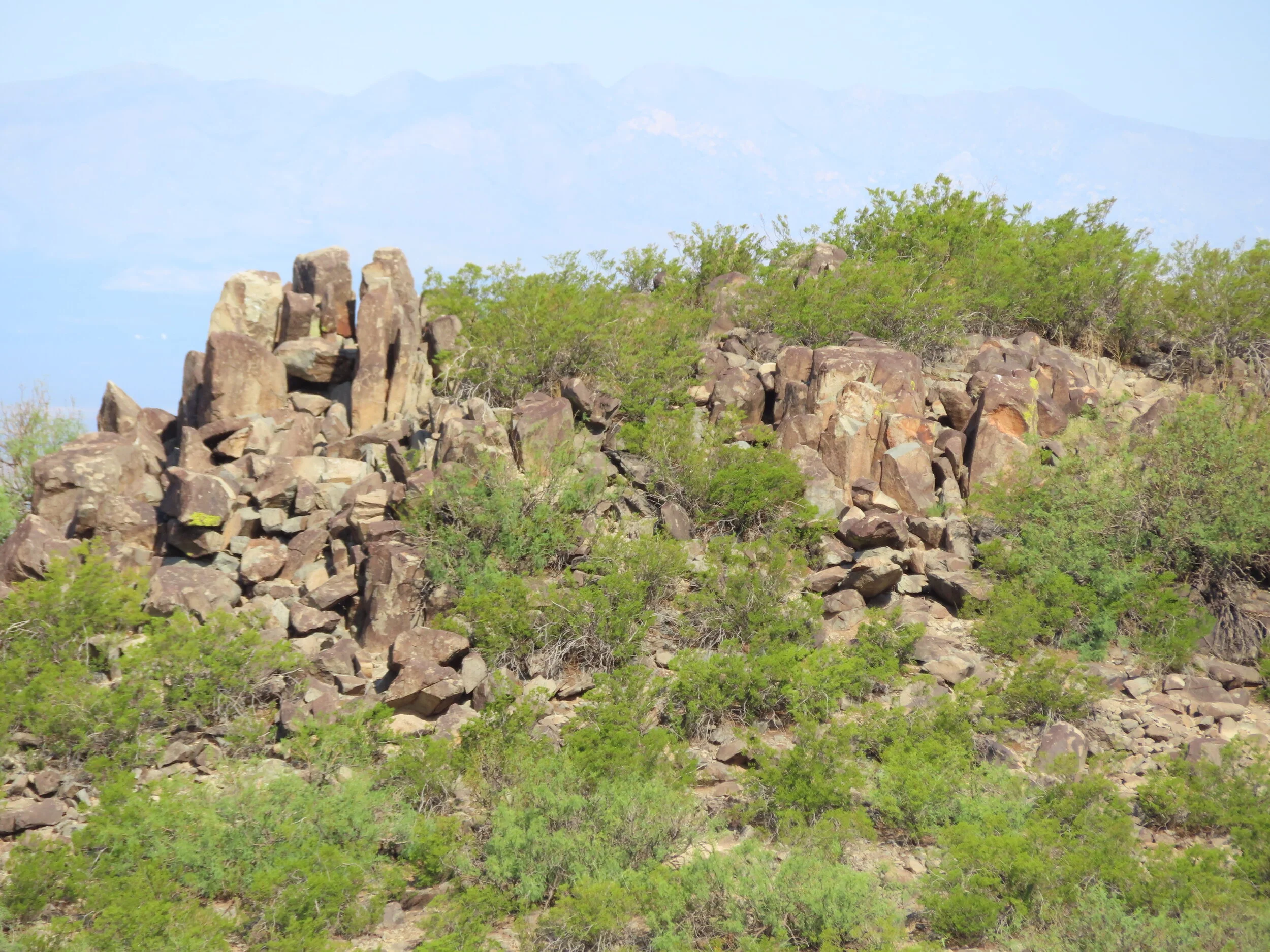
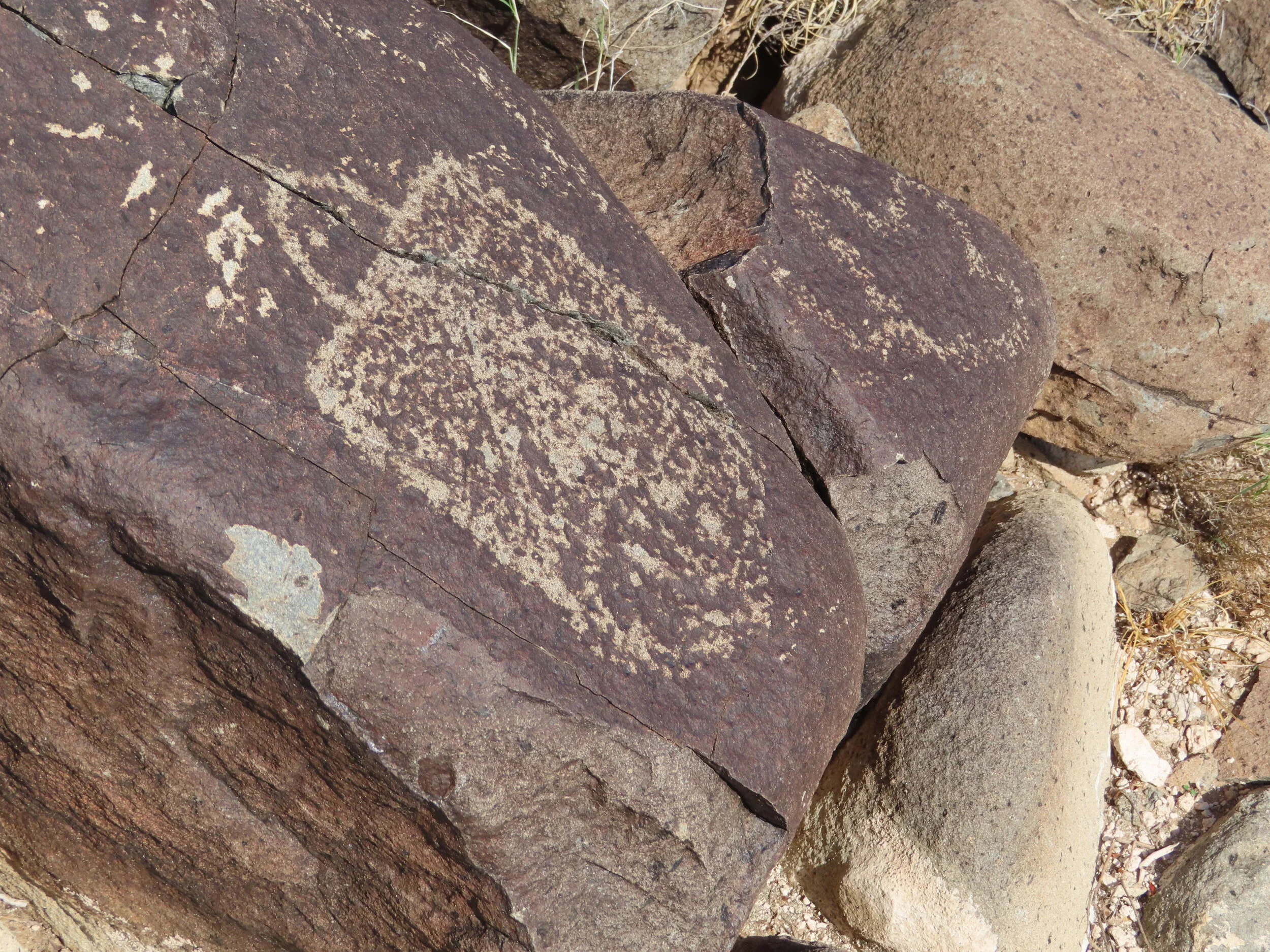
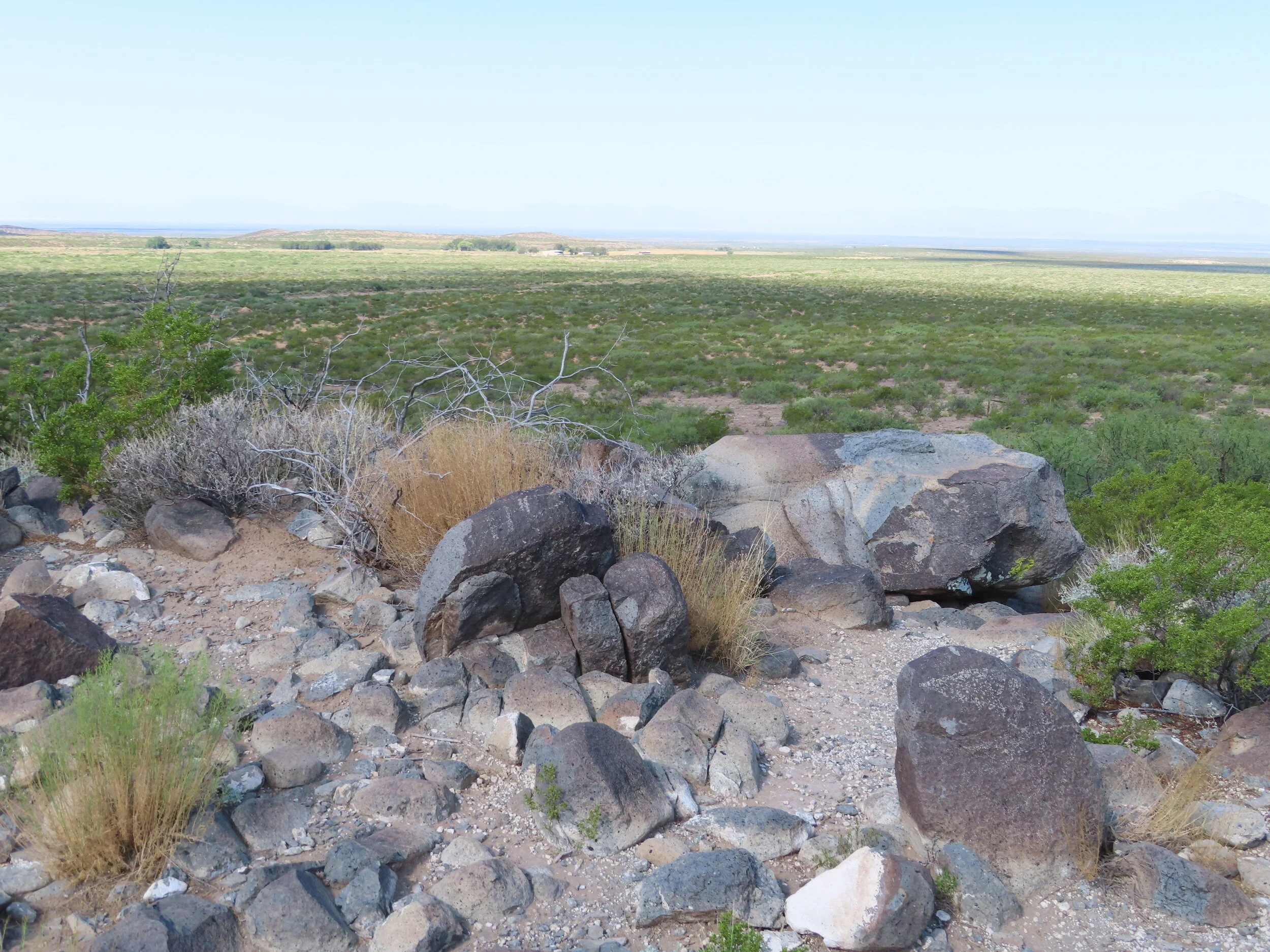
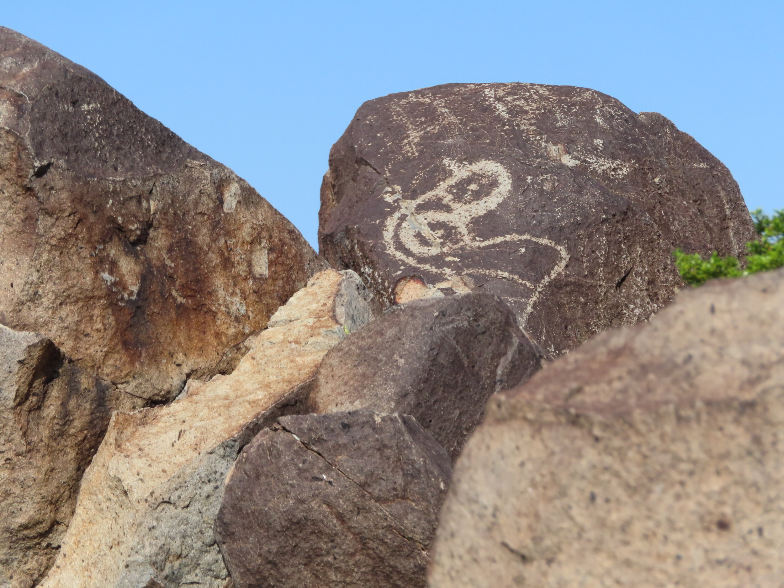
· First stop was Three Rivers Petroglyph site. Was supposed to camp there the previous night but it was closed. The site was open since it’s nothing more than a loop trail with a bunch of rocks to look at figuratively in the middle of nowhere. Somehow I got a ticket put on my bike by an overly excited BLM site host for not displaying my America the beautiful card (Who leaves a credit card like pass on a mirror hanger on a bike? Not this guy!) despite filling out the fee slip and putting ATB number on it. Anyway, I got his wife’s attention and showed her the card and explained why I didn’t leave it hanging from the bike. She retracted the ticket.
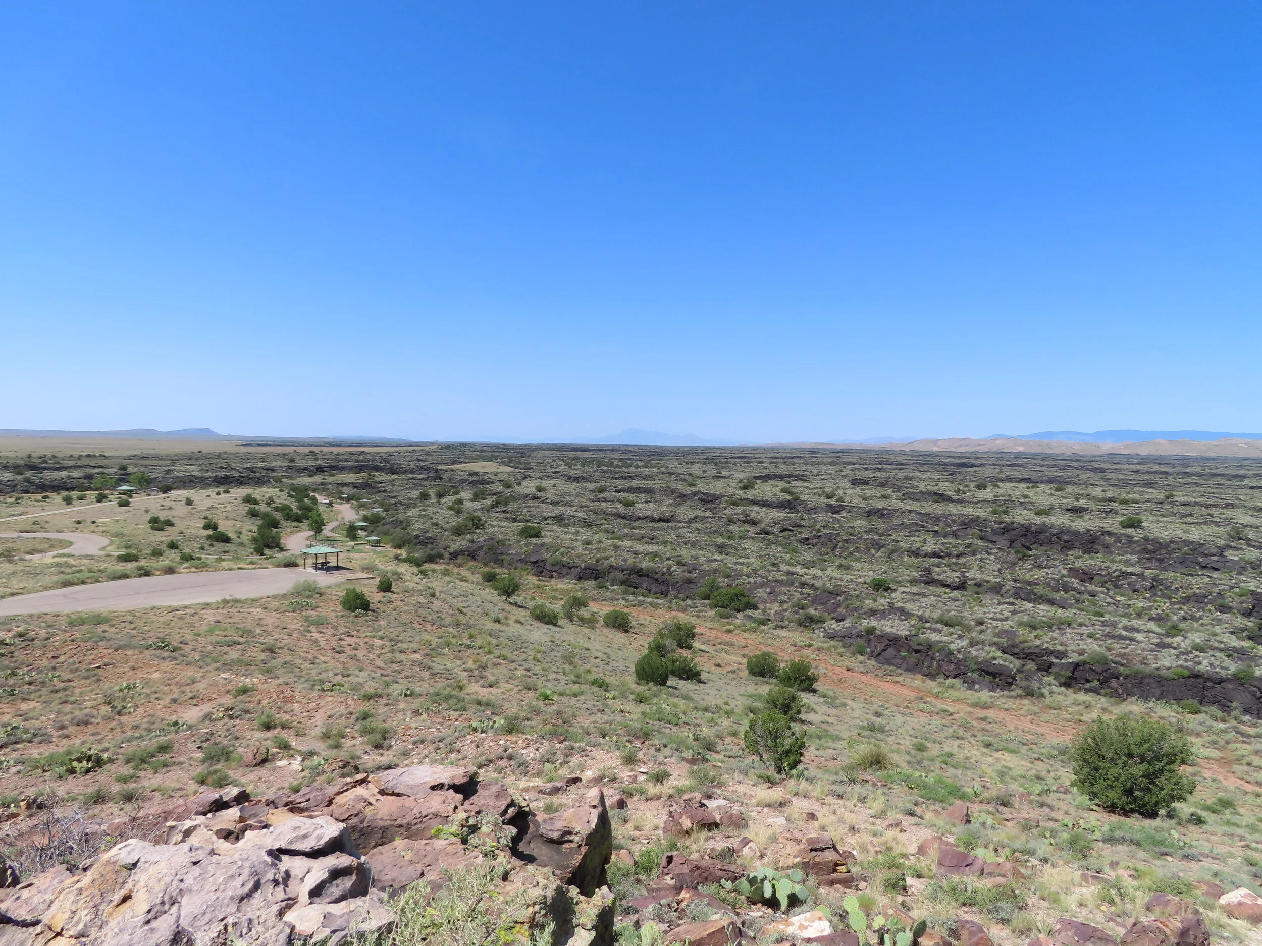
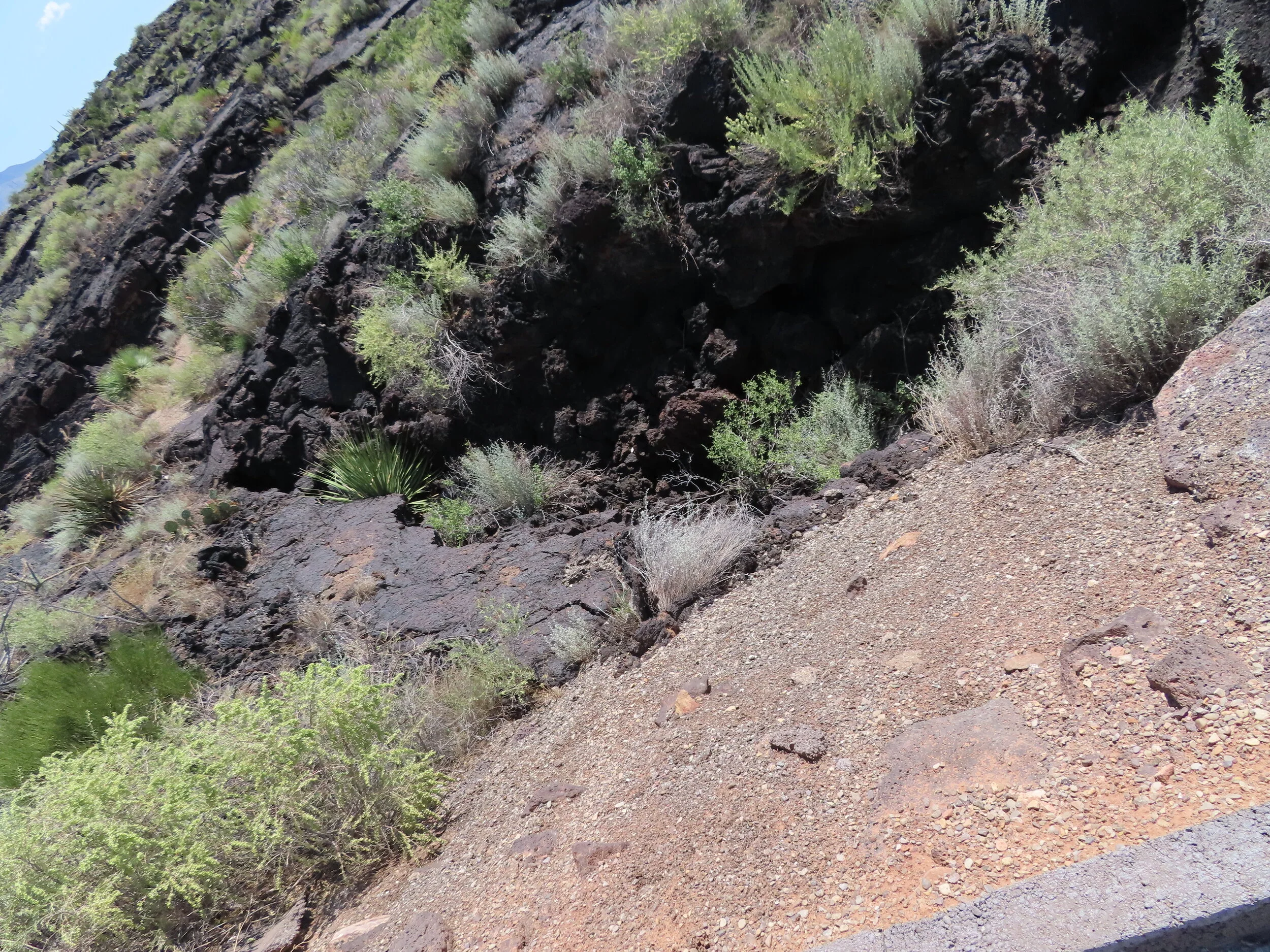
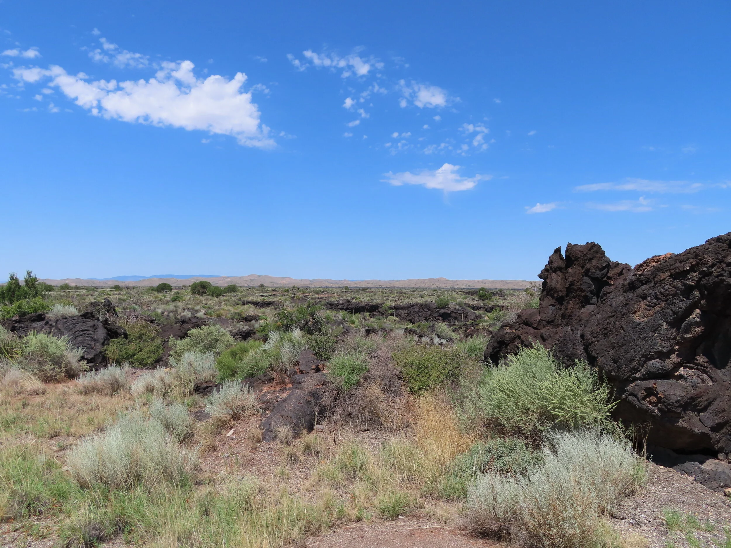
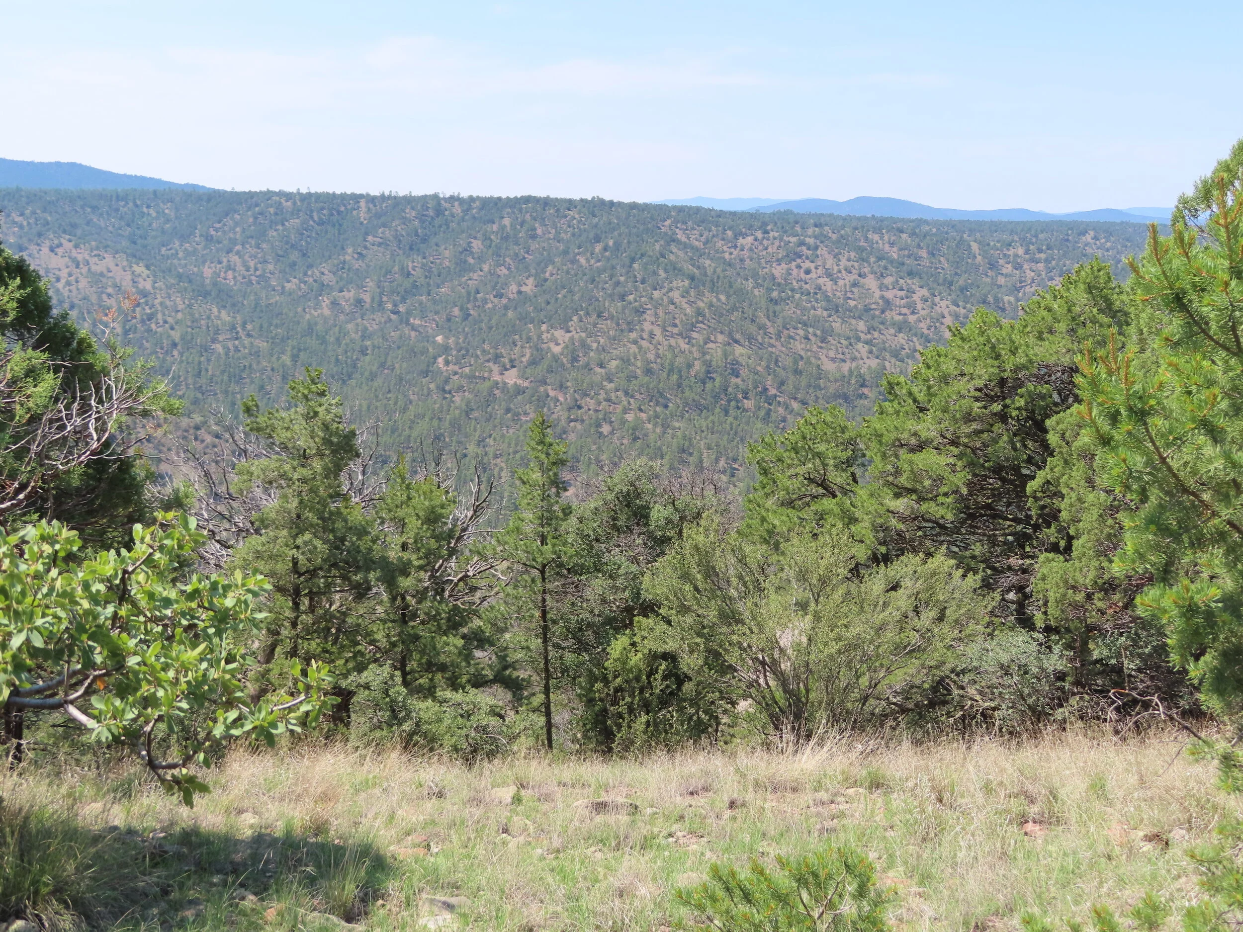
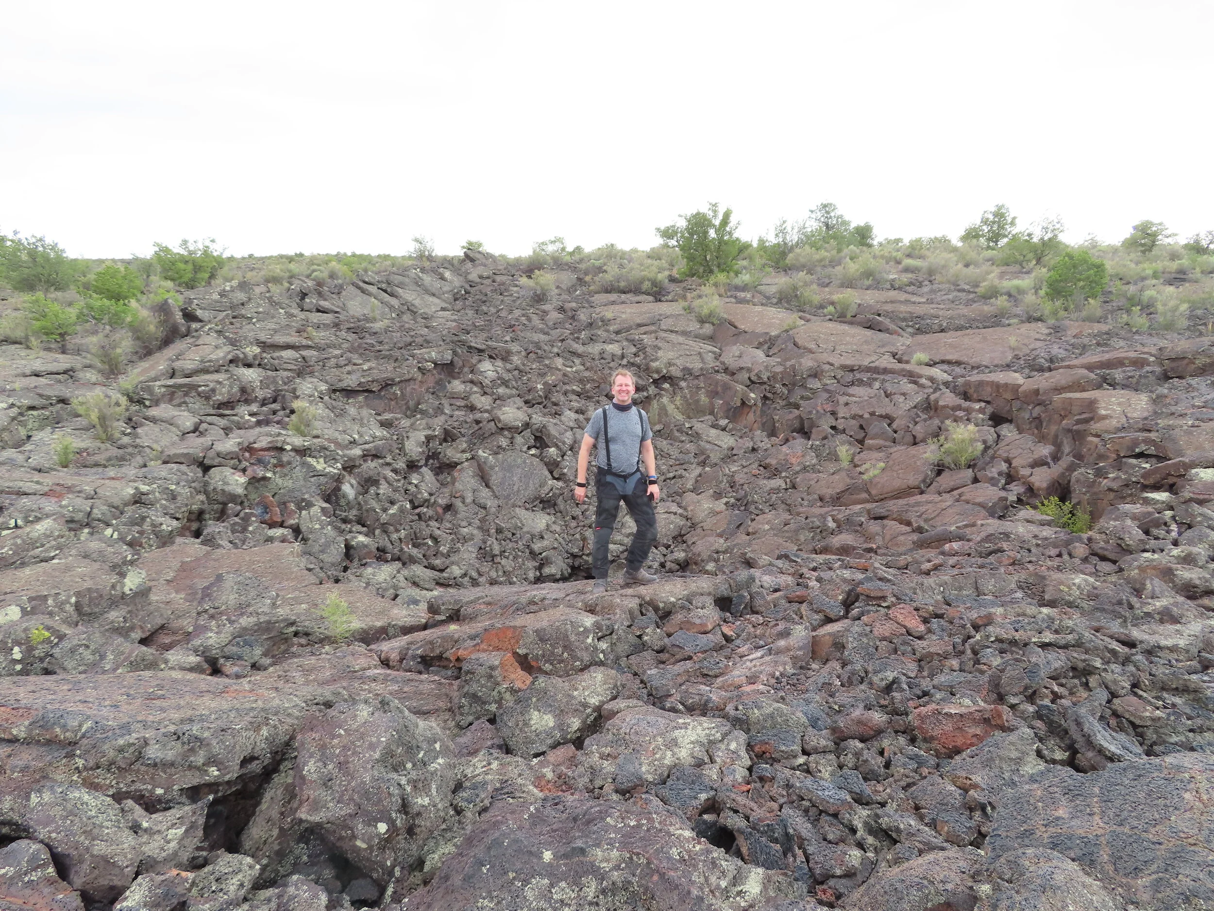
· Next stop, Valley of fires. Valley of Fires is adjacent to the Malpais Lava Flow. Approximately 5,000 years ago, Little Black Peak erupted and flowed 44 miles into the Tularosa Basin, filling the basin with molten rock. The resulting lava flow is four to six miles wide, 160 feet thick and covers 125 square miles. The lava flow is considered to be one of the youngest lava flows in the continental United States. In total it is approximated that the eruptions lasted around 300 years.
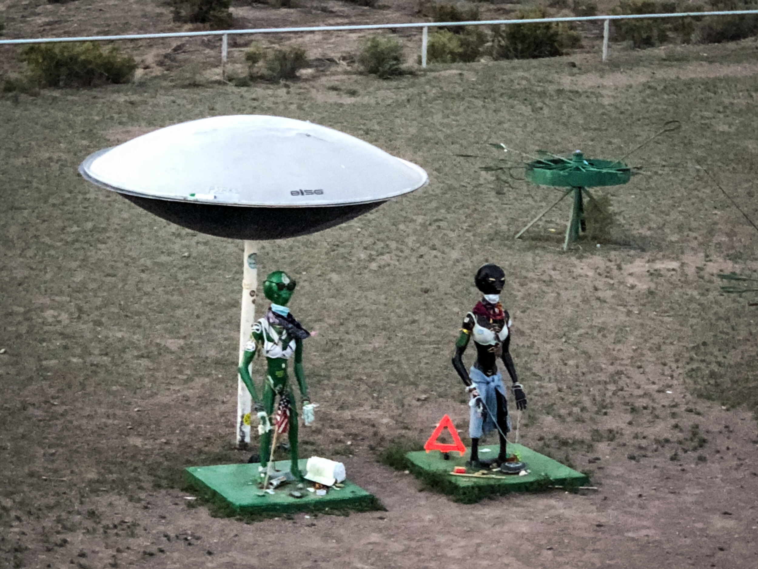
I won’t talk much about the “Alien Loop” as it is a little like “Fight Club”, We all know the rules of Fight club! My request to gain access to the site was neither confirmed or denied!

Talk about nothing around, only cattle for 3+ hours

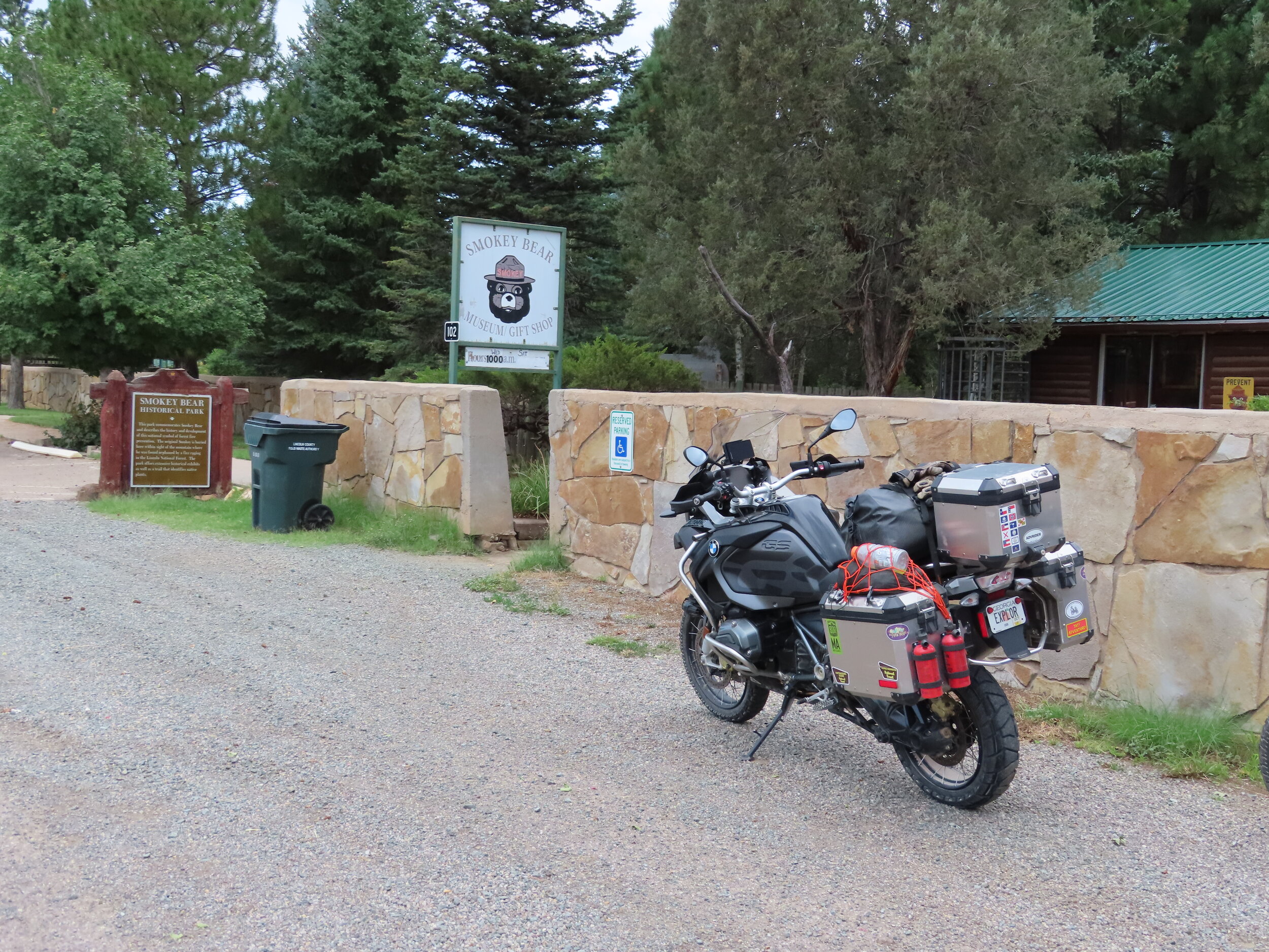
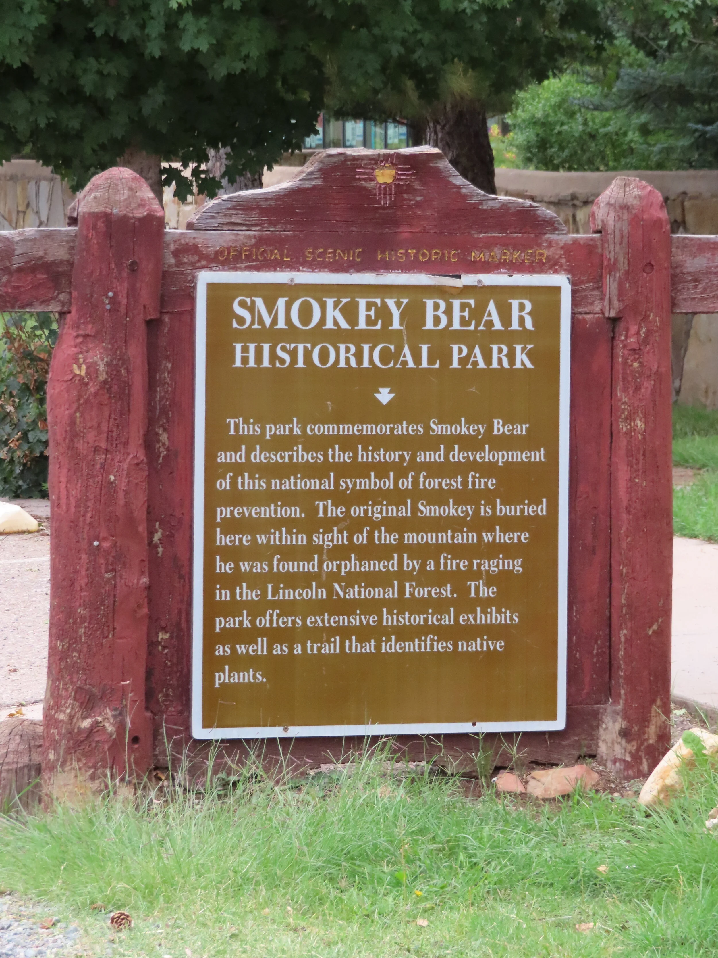
Time to head back south from Carizozo. We stopped at Smokey the Bear’s museum in the village of Capitan and learned a bit of behind the scenes info about ole’ Smokey. First, his nickname was “Hotfoot” since he was burned in a forest fire in 1950. After healing up, he was renamed Smokey. He got a new home at the Washington National Zoo alongside fellow celebrity “Ham” The Astro Chimp where where they spent many years. Smokey was so popular, he had his own ZIP code. Smokey was returned home after his death and buried at the museum early November of 1976.
Side note: I learned after returning home, Ham was buried in Alamogordo where we were the night before.
Day 1:
El Paso, TX
Antelope Wells, NM
Silver City, NM
Stats:
Miles: 319
Ride time: 9:07
Avg Speed: 35.1
Temp: 72° - 100°
Altitude: 3,722 min – 6,341 max
Notes:
Lodging – AirBNB – sort of a granola girl healing retreat
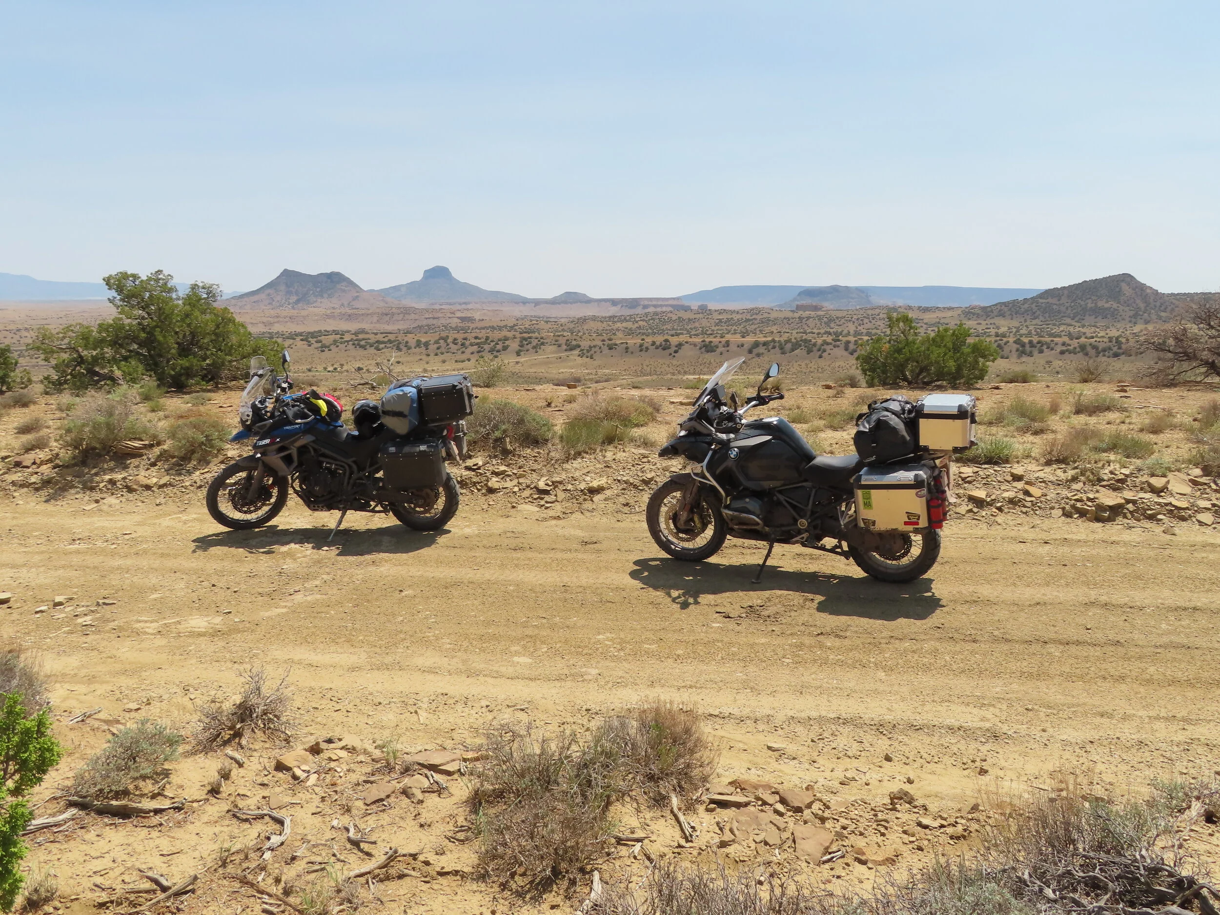
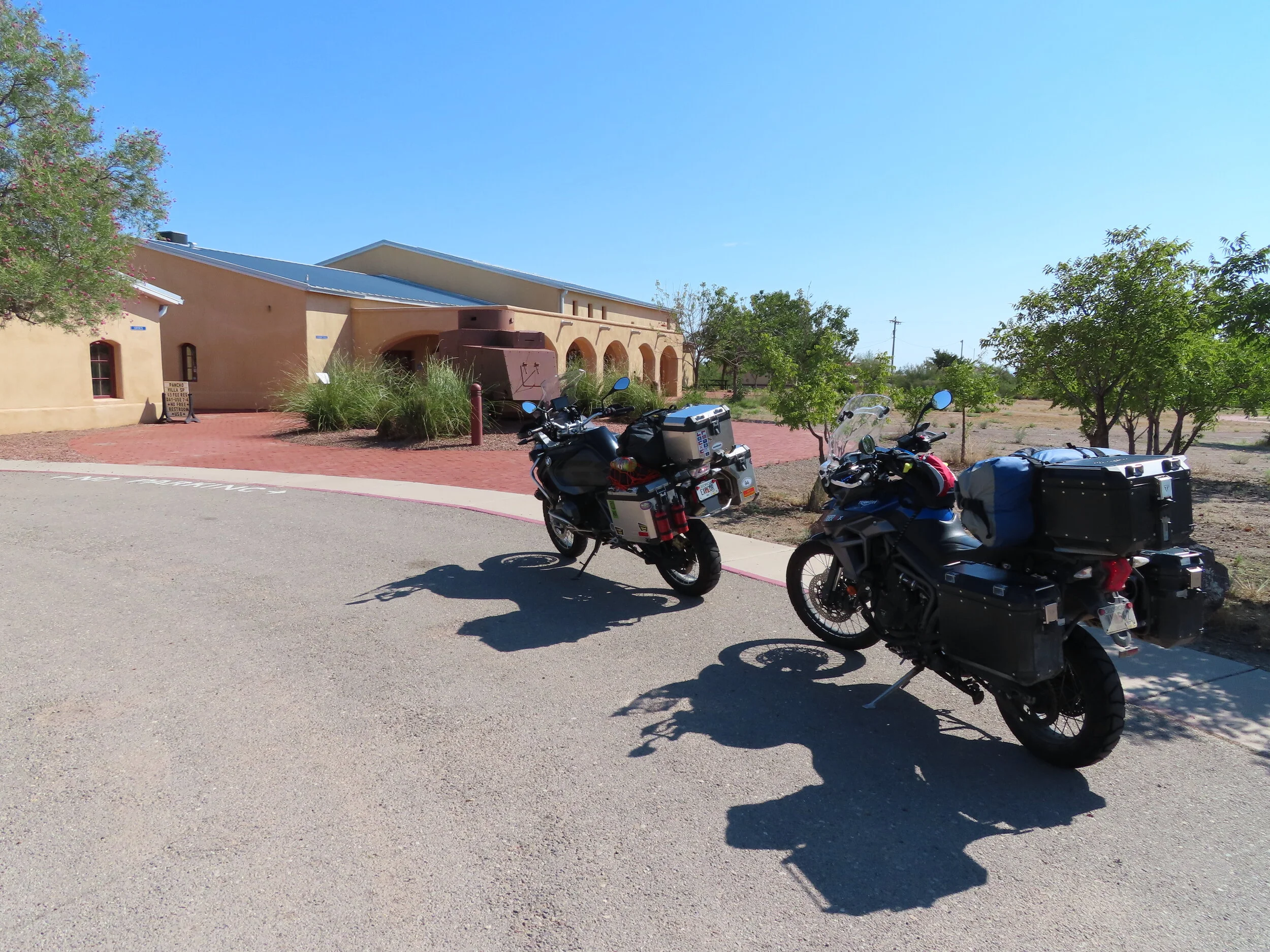
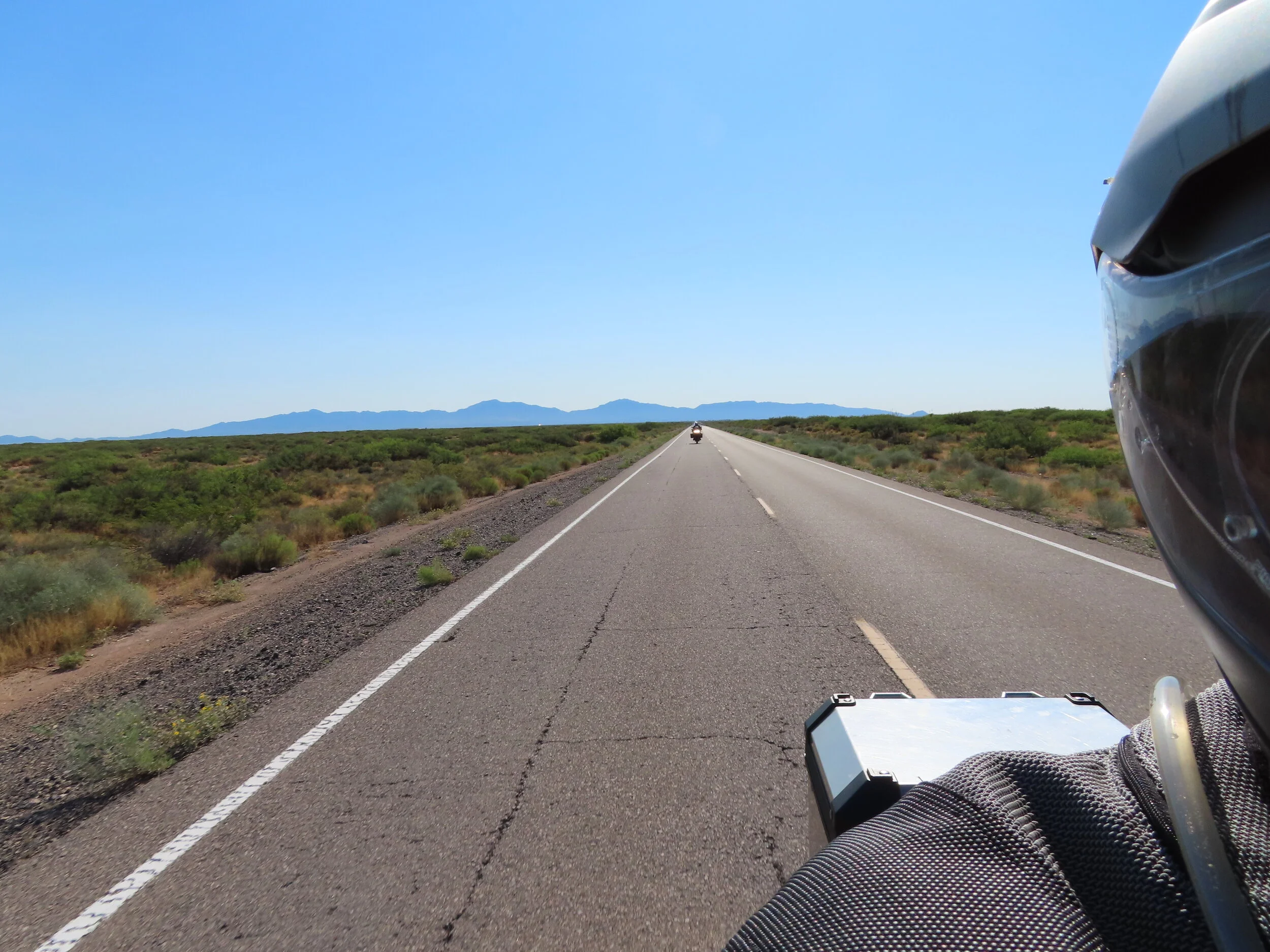
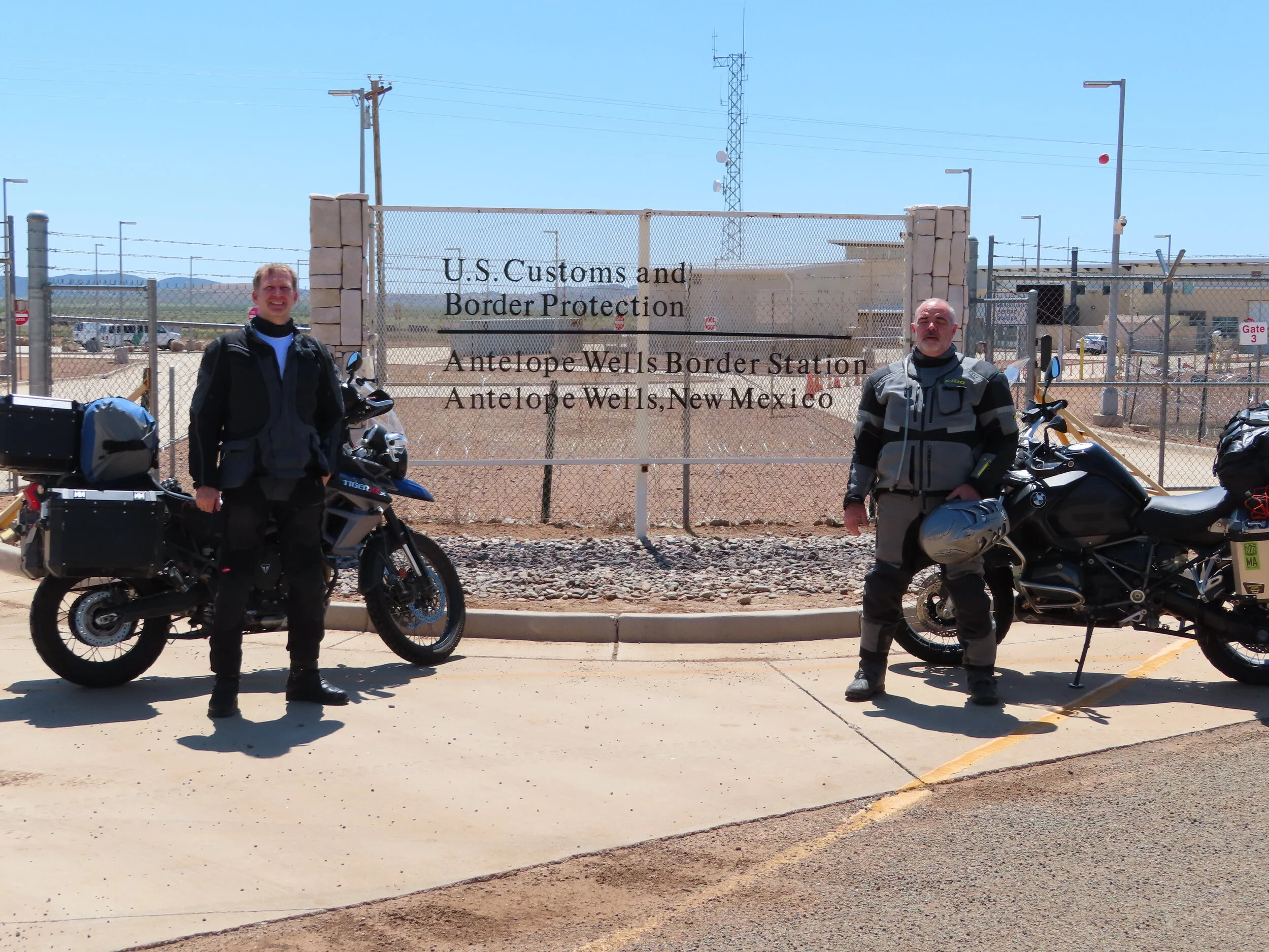
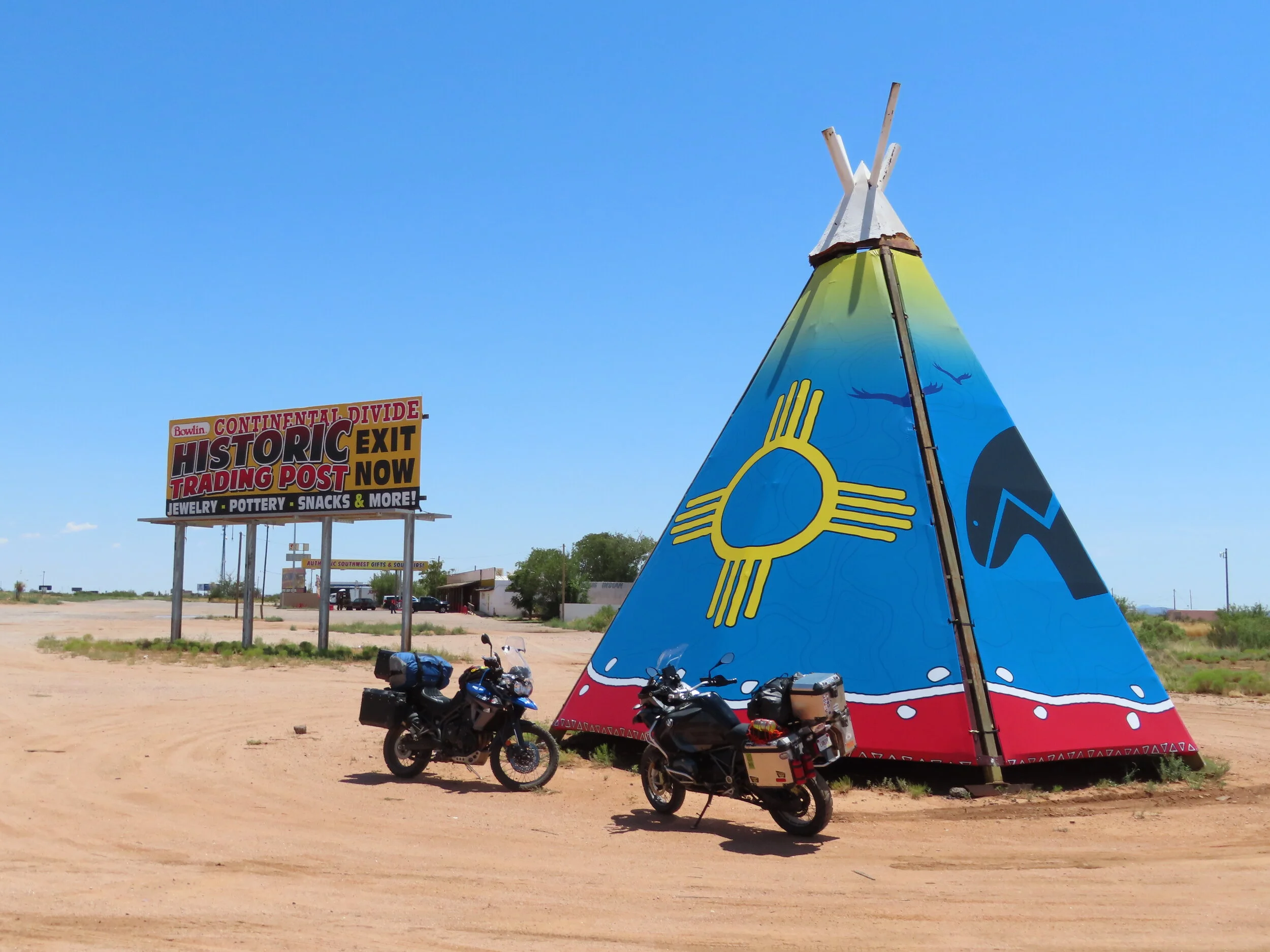
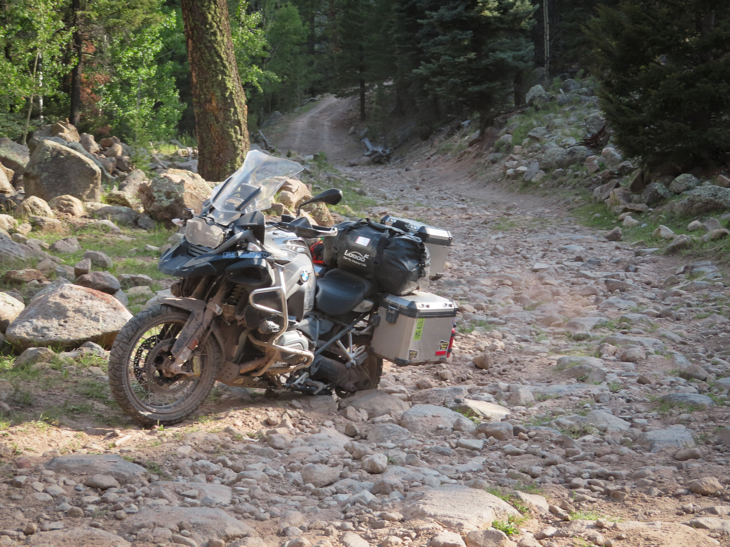
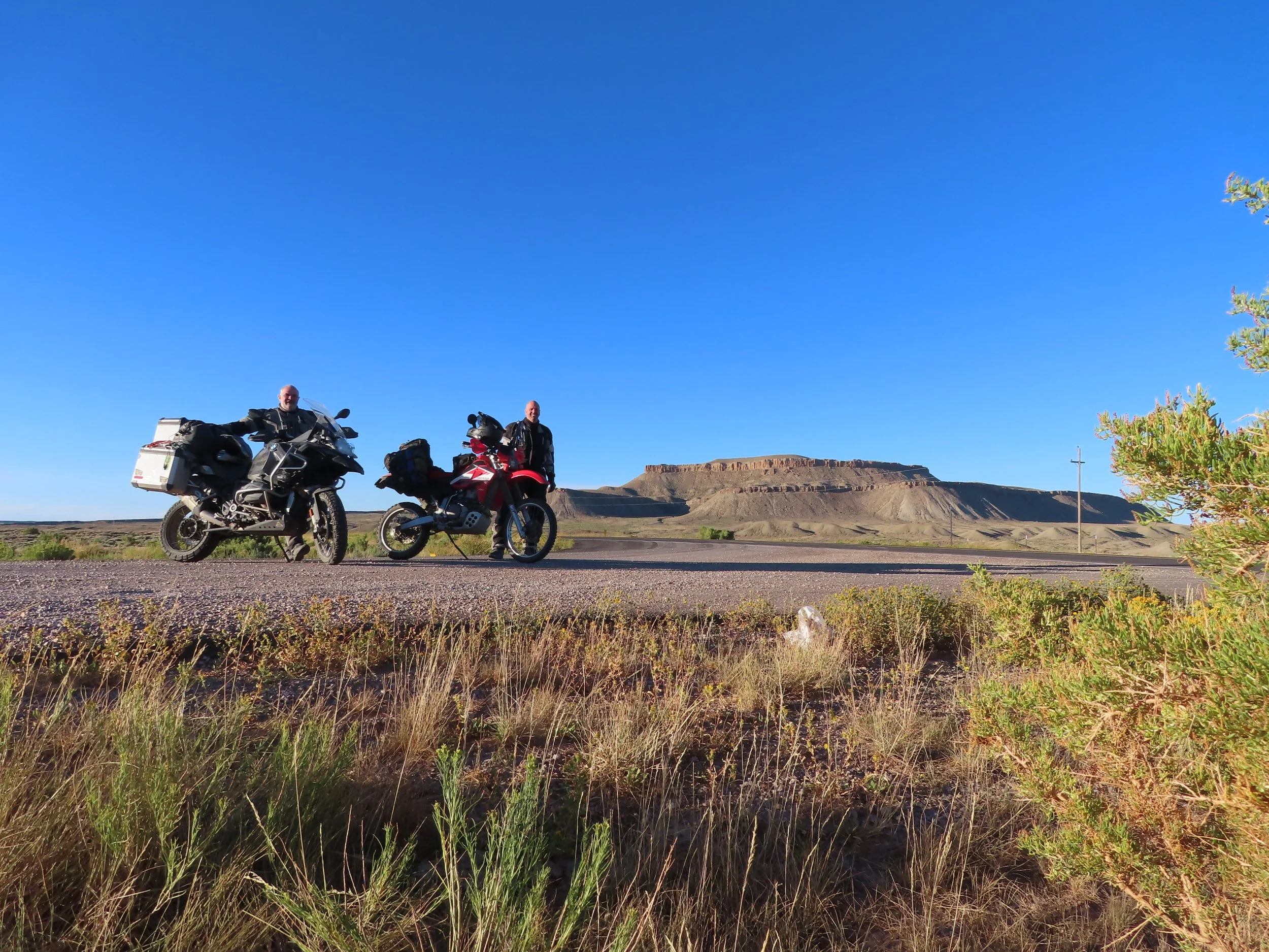
Ride – It’s officially kickoff time!!! Great start today, on the road by 8:30 following GPS track we ran into a snag early on. The scenic road that goes over the mountain was closed to vehicles, only open to foot traffic. Quickly came up with a work around that was a mile or two away. Quickly got back on route on our way to the border for a photo opp. We made a stop for gas in Columbus N.M and to check out the location of the Poncho Villa raids of 1916. I pointed out to Albert that this is the deviation point for the COVID bypass. Pointing south telling him we were supposed to enter Mexico a few miles down that road. We continued west towards Hachita. Once in Hachita we then headed south to the border. We were greeted by a plain white pickup truck. I was thinking it was a border patrol agent about to tell us the border was closed and we needed to leave but it turns out that the driver was an ADV rider and he was working on communications for the facility. We chatted with him for around a half hour and he offered to take our pic at the border sign. He mentioned that he sees 3 or 4 ADV riders each week, a handful of bicycles and hikers too coming to do the same thing we were doing. I asked him about all of the border agents we saw along the way specifically asking if they gave out speeding tickets. He said “No, you will not see a cop till you get to I-10. I usually go around 90 miles per hour on the way in to work”. We averaged around 90 all the way back up to Hachita. We had a ghost town side bar but couldn’t find the ghost town. Mainly because I had not activated it on my GPS. I thought it would be confusing to have all routes lit up which would have been especially confusing in Hachita as the one main intersection would have pointed us in all 4 directions. I realized that the sidebar leg wasn’t on only after abandoning it. We continued north towards I-10. As we were getting to I-10 is where we began the first dirt portion of the CDR. We followed an access road next to the highway and train tracks until reaching Separ N.M. and the home of the Bowlin’s Continental divide store. No gas here and the store was mostly a souvenir shop. Heading north out of Separ is the first taste of desolate riding. We had a few hours of dirt / sandy conditions. Albert needed gas from the spare bottles that I cary as he didn’t have enough range to make it to Tyrone. Just before the city of Tyrone there is a large open pit copper and gold mine which was a pretty neat sight to see. After gassing up in Tyrone it was a short distance to the air BnB in Silver City. Dinner was a Mexican joint that charged for EVERYTHING since New Mexico is “to-go” only (thanks yet again COVID!). Chips $2, Salsa to go with those chips… another $1.50. Lady even wanted to charge us for water while we waited!! Storm was rolling in and it was a bit windy too. Took dinner back to air BnB and had it on Albert’s rooftop terrace as the storm passed north of us without raining on our parade. Bed time, I got the crap scared out of me finding a friggin’ tarantula crawling across the floor in my bedroom!!!
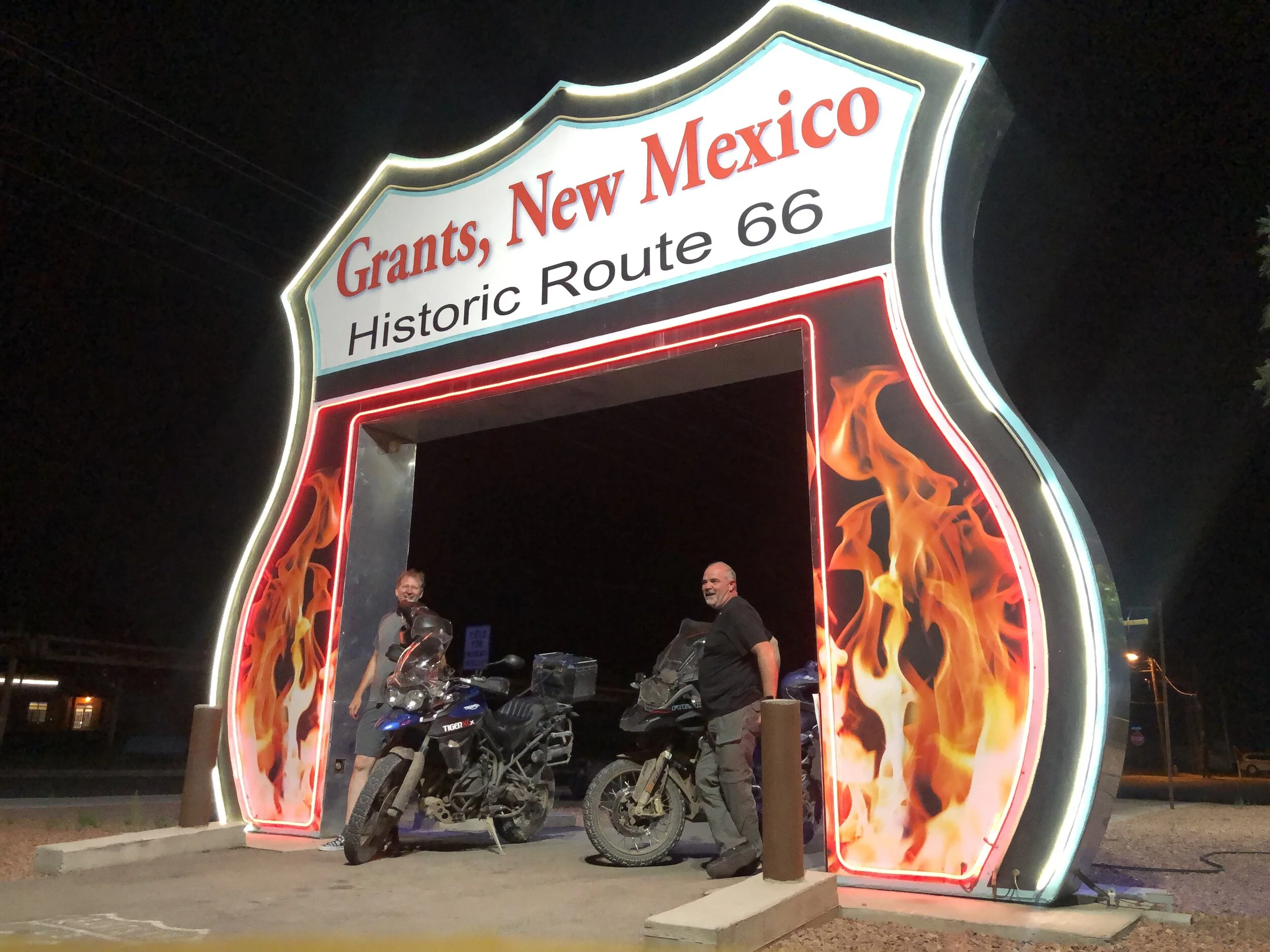
Day 2:
Silver City, NM
Grants, NM
Stats:
Miles: 275
Ride time: 7:02
Avg Speed: 37.3
Temp: 60° - 97°
Altitude: 5,916 min – 8,095 max
Notes:
Lodging – Days Inn
Ride –
· Good start today, on the road before 8:30.
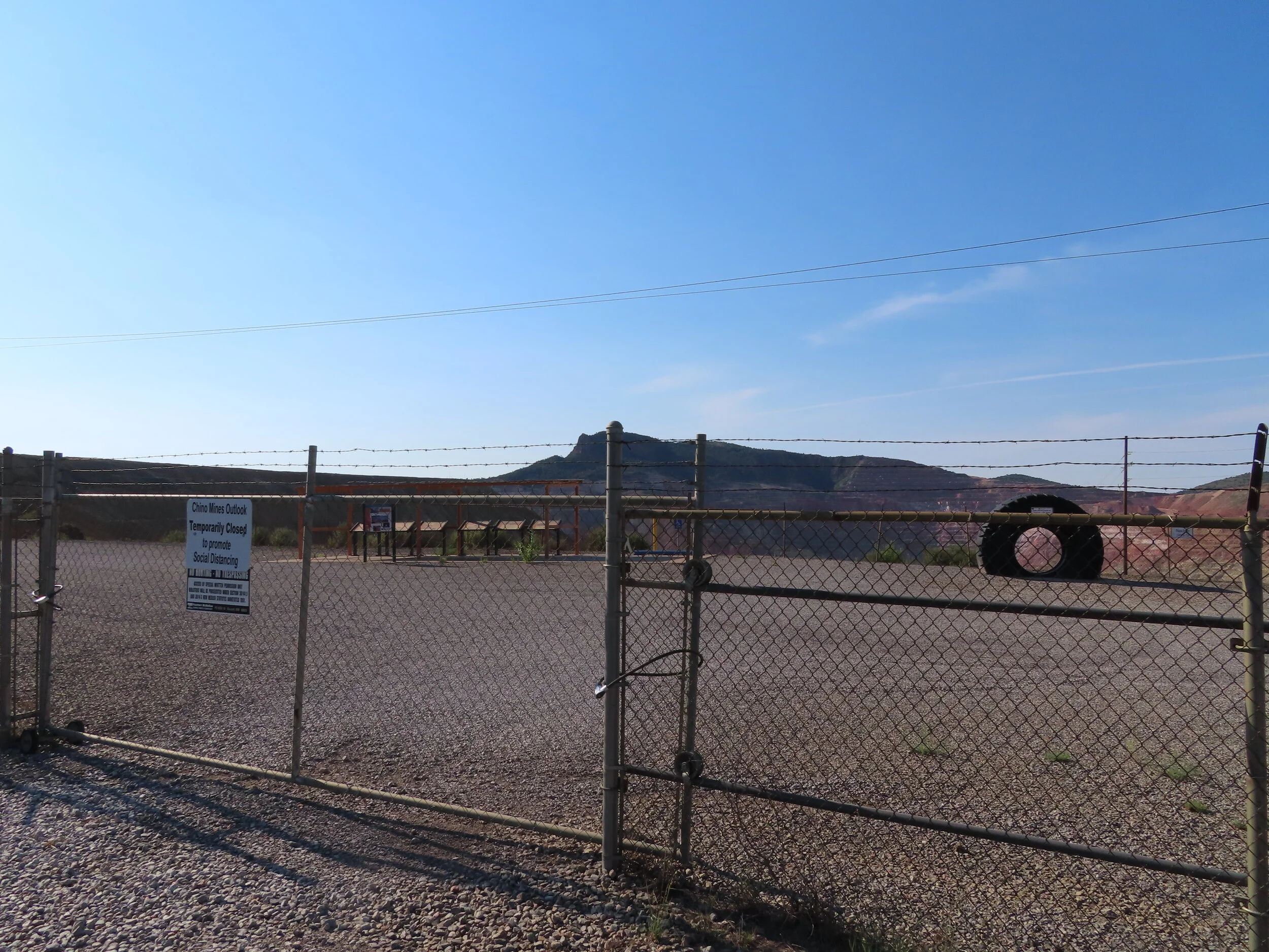
· Shortly after getting on the road we saw another huge open mine. Gates were closed due to COVID. See the trend here? I understand social distancing but the mine is about 3 square miles and no one really hanging out watching it get mined. Understandibly it was closed to promote social distancing but it is outside and the placards were already 10’ apart. Oh well, we did get to see a lot of the mine set aside from standing up om my pegs and looking as we rode by.
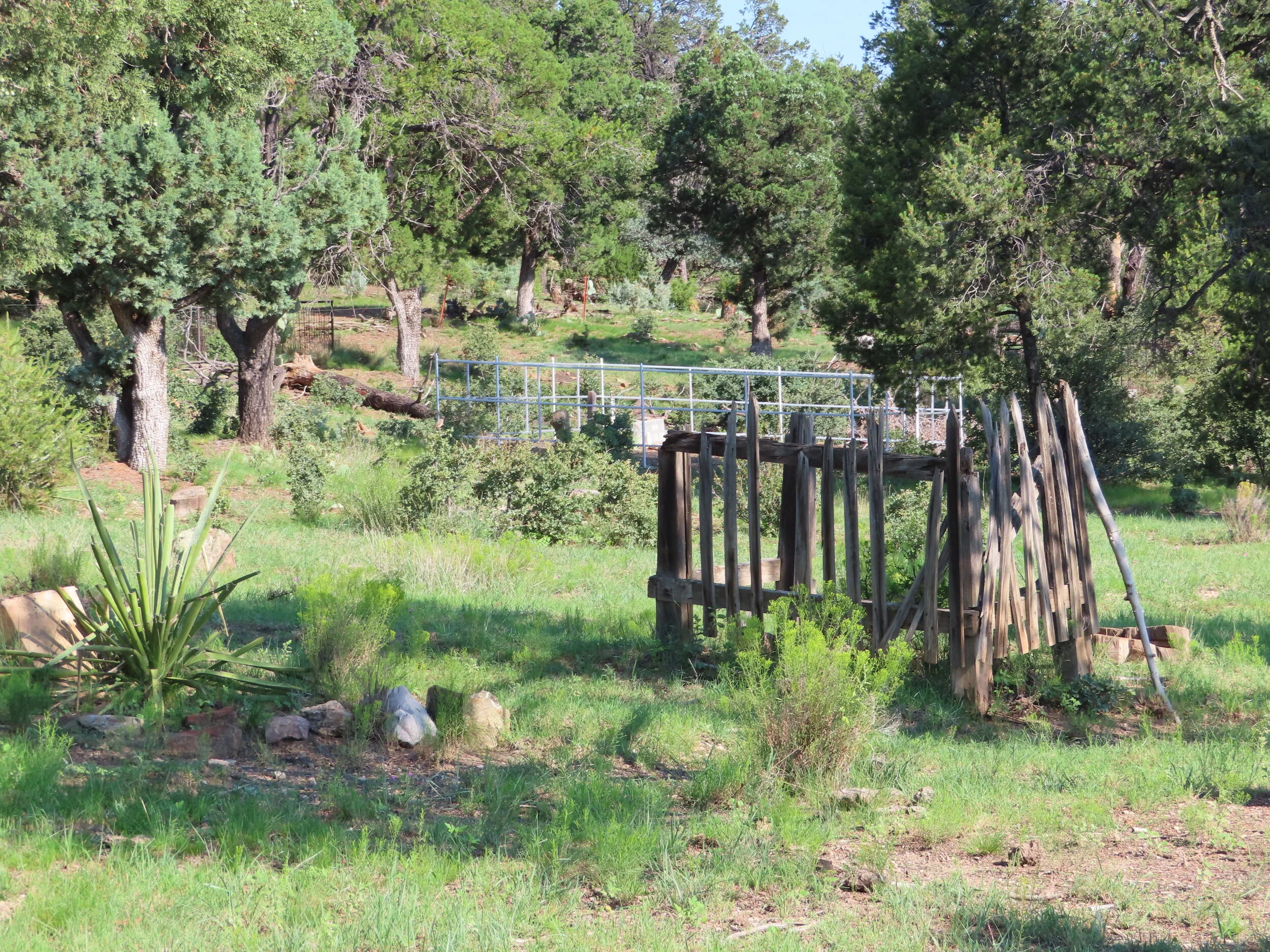
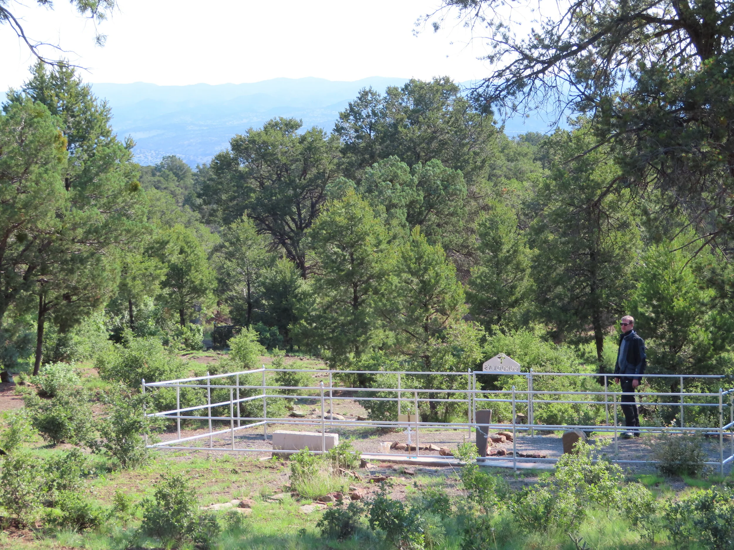
· Continuing on we found a point of interest called Georgetown cemetery. I believe the oldest grave there was from the late 1800’s!
· As we rode along we encountered some fresh grading, so fresh that after a few miles of it, we caught up to the grader. Once we passed him the road was hard packed and our speed really increased. Even if there were a crazy amount of washboards.
· Wanted to fit in the Gila Cliff Dwellings monument if possible today got as close as 35 miles away and totally blew the GPS turn off thinking we were getting close enough to go and see it. It would have added @ 70 miles to the day. I just didn’t see it happening. So we kept true to the blue GPS line.
· Somewhere around Bear Canyon (Magdalena N.M.), I decided…..Mamba decided it was time for an impromptu dirt nap. Talking me ass over tea kettle along the way. I kicked the ever loving fire out of the brush guard during my unexpected and unplanned dismount. Perfectly placed under my knee/shin guard and above my boot. That bruise lasted the rest of the trip and a week + once we made it back home. Not the souvenir I was looking for but it made “ lasting impression”.shall we say.
· Pie Town’s, Pie-O-Neer Pies is permanently closed. Thanks again COVID :-/ No Pie here (we were pretty late in the day too).
· Couple of stretches of mud after Pie Town. Was a little nerve racking.
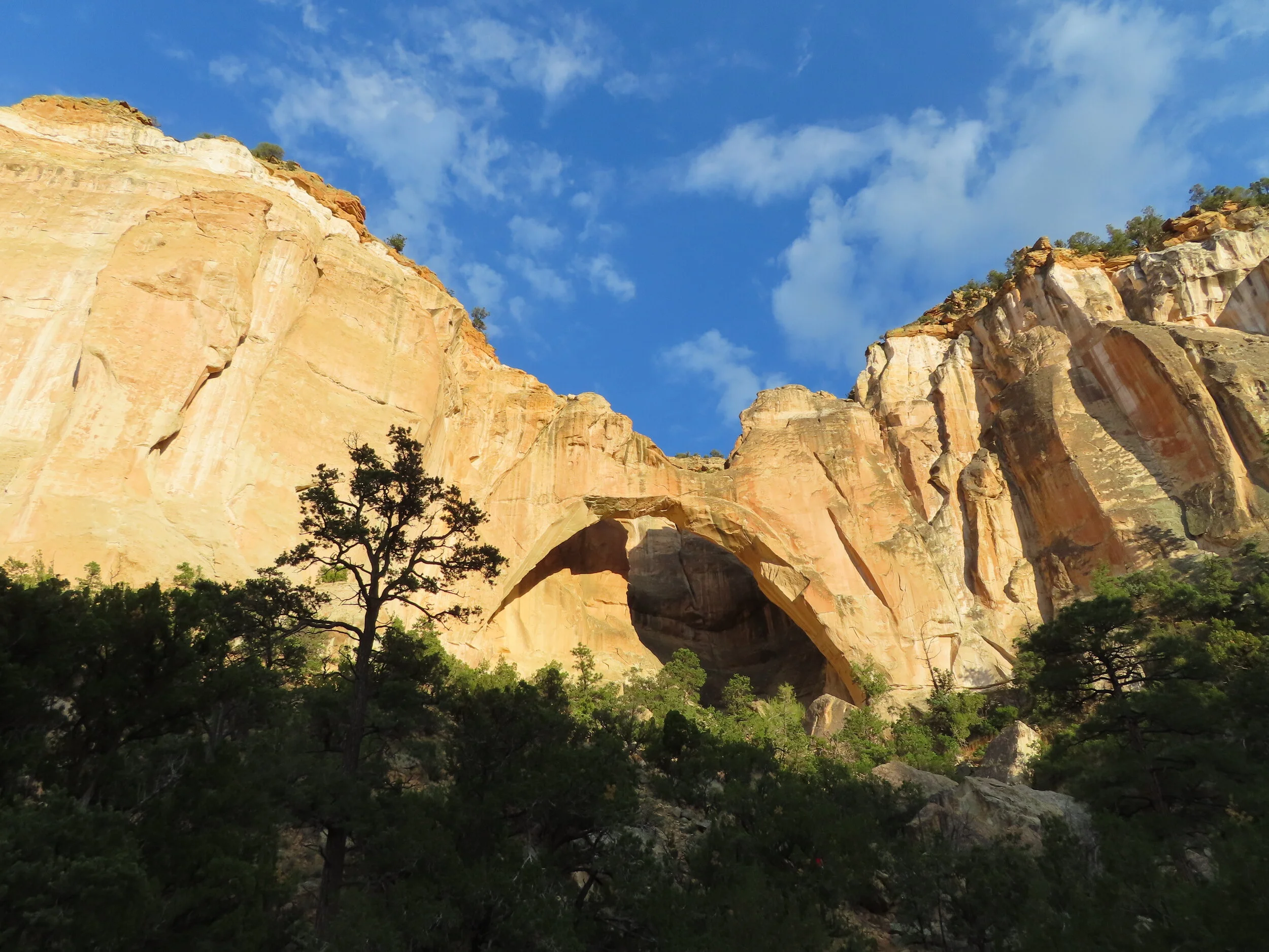
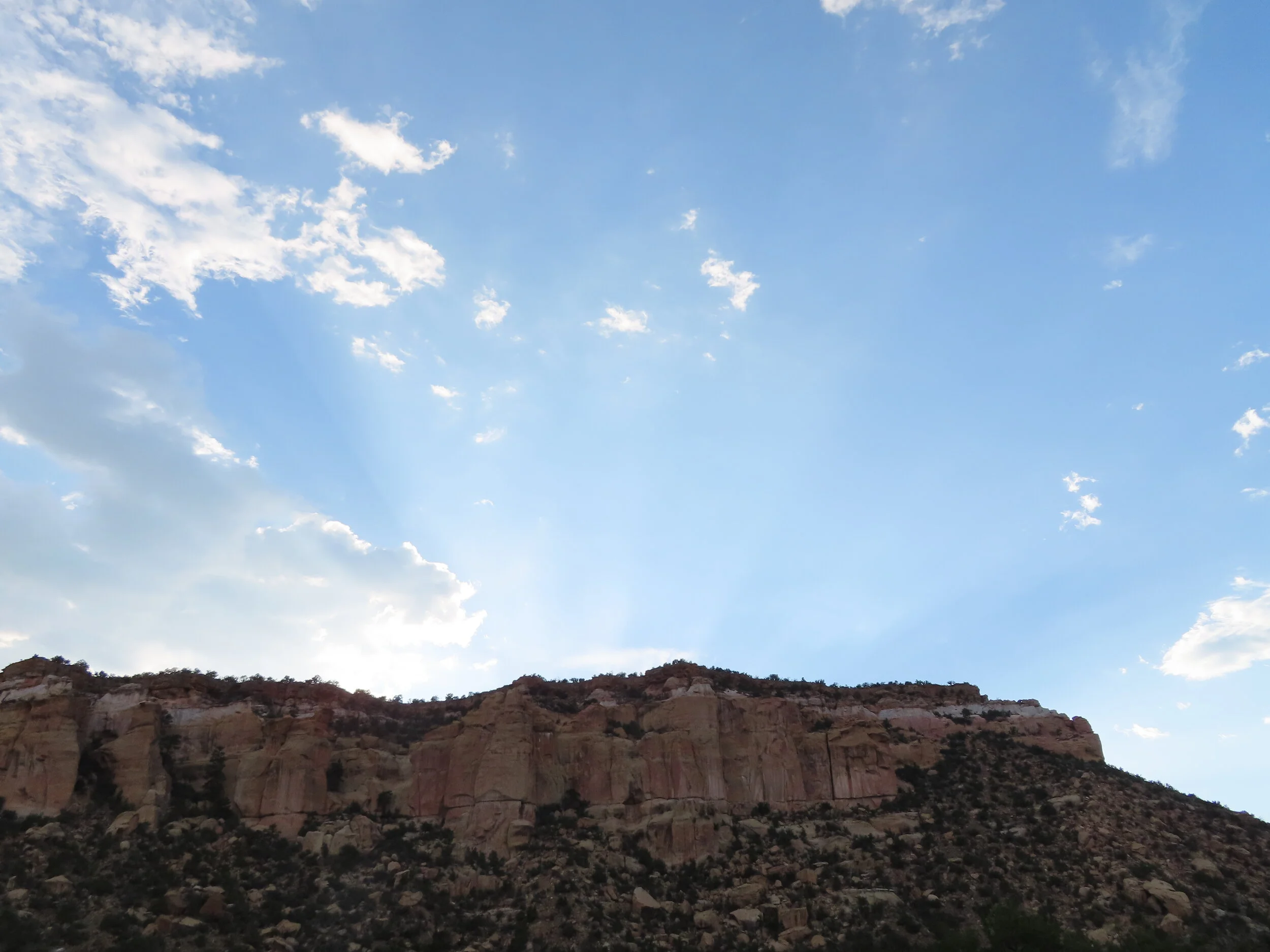
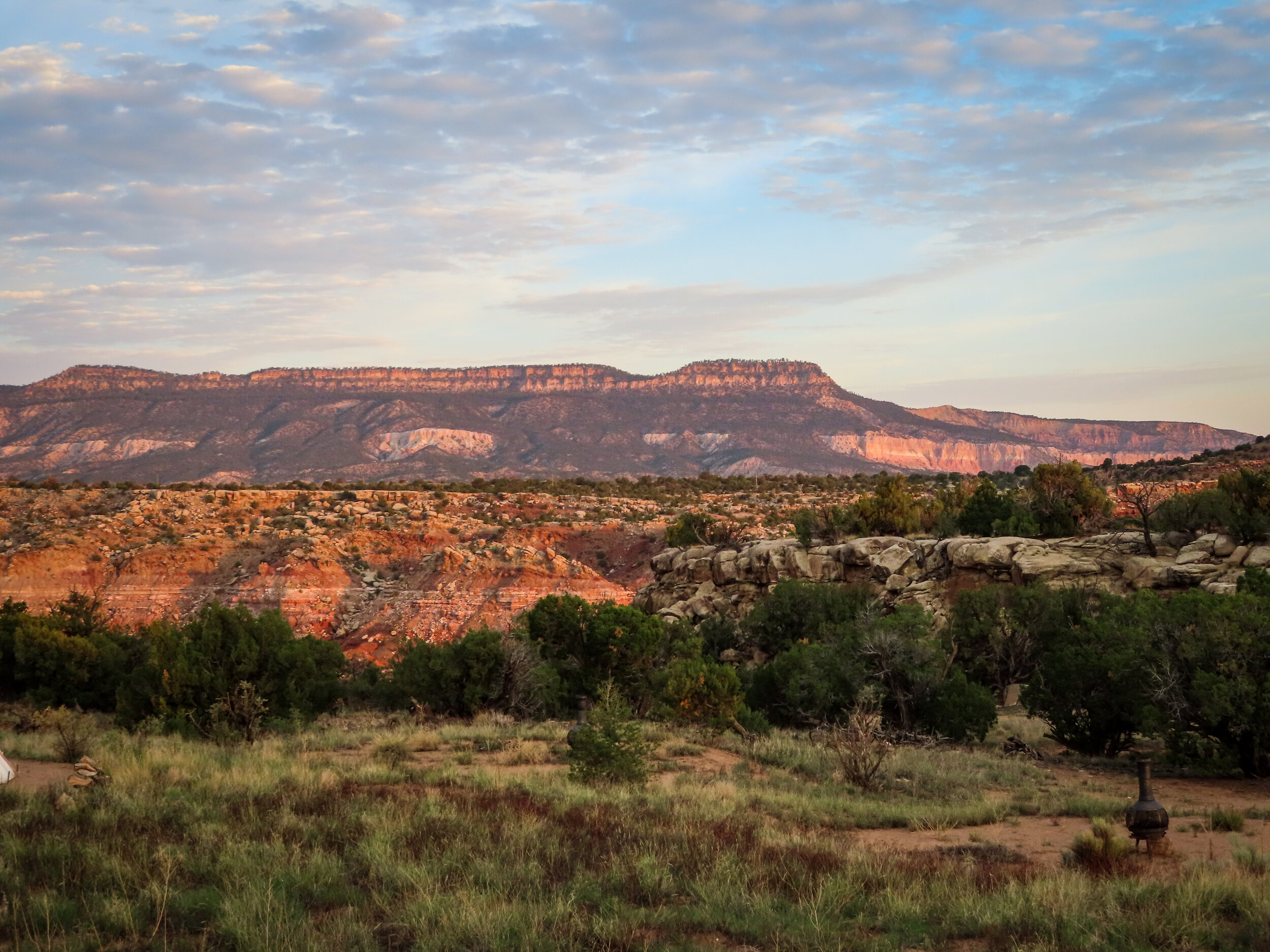
· Getting late in the day, due to mud sections taking a few extra hours along with Albert’s cow wrangling adventures we took green (Easy) route for final leg. Not a bad thing as we found “The Narrows, another lava flow and the Sandstone Bluffs. Awesome photos all the way!
· Most everything was closed in Grants. The hotel had an advertisement for a close by brewery. We went to find they didn’t serve food but the lone bartender was incredibly interesting. I think his name was Bob or Bill. His day job is contract work as a photojournalist for Getty images. Lots and lots of stories. Anywhere from Photographing Bill Clinton on Airforce 1 to Mexican drug cartel parties. Interesting man to say the least.
· Our hotel neighbor called me a look-alike of Sean Connery from the 007 days (not my first time for this. Happens a lot more often after not shaving for a week or so.).
· Went into town down Route 66 for some dinner to find everything closed and a very long line at McD’s. Back to the hotel for a freeze-dried camp meal.
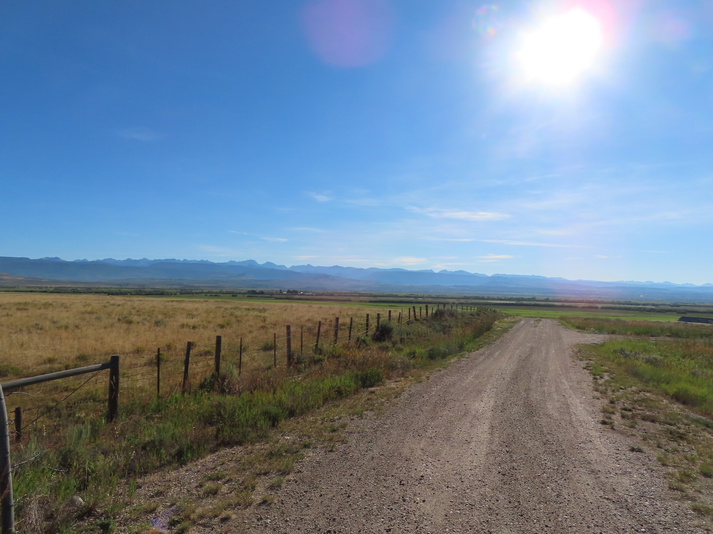
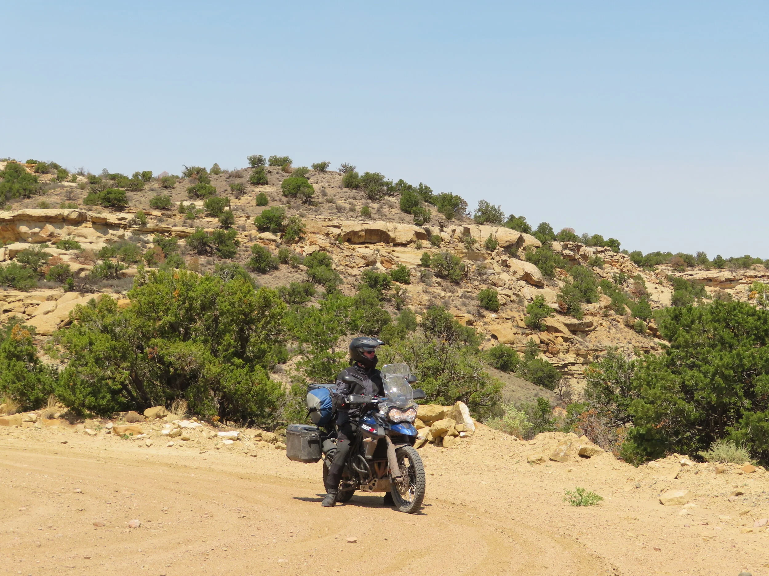
Day 3:
Grants, NM
Cuba, NM
Abiquiu, NM
Stats:
Miles: 221
Ride time: 9:02
Avg Speed: 23
Temp: 61° - 104°
Altitude: 5,903 min – 10,331 max
Notes:
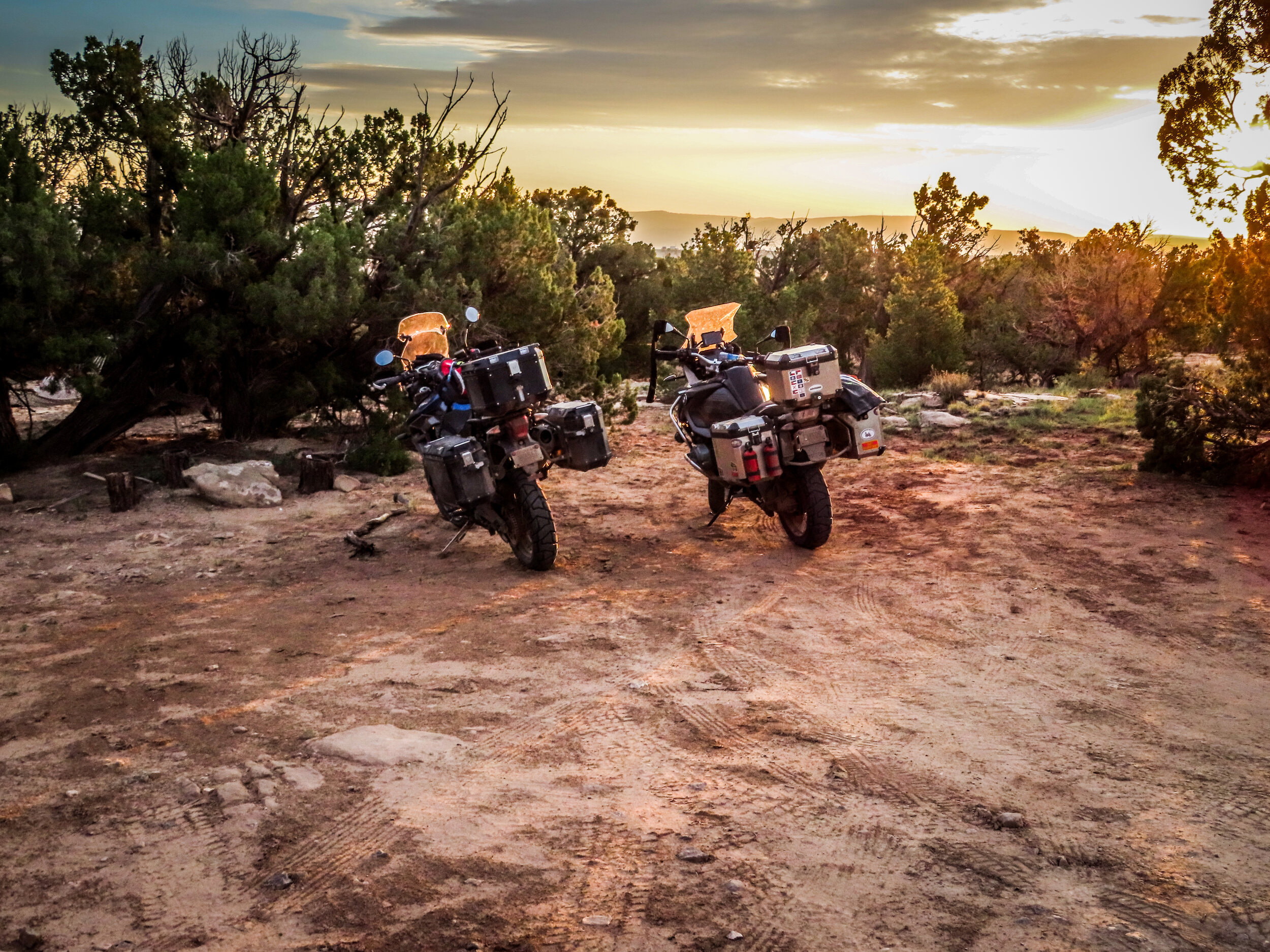
Lodging – Camping at a hippie healing retreat
Ride –
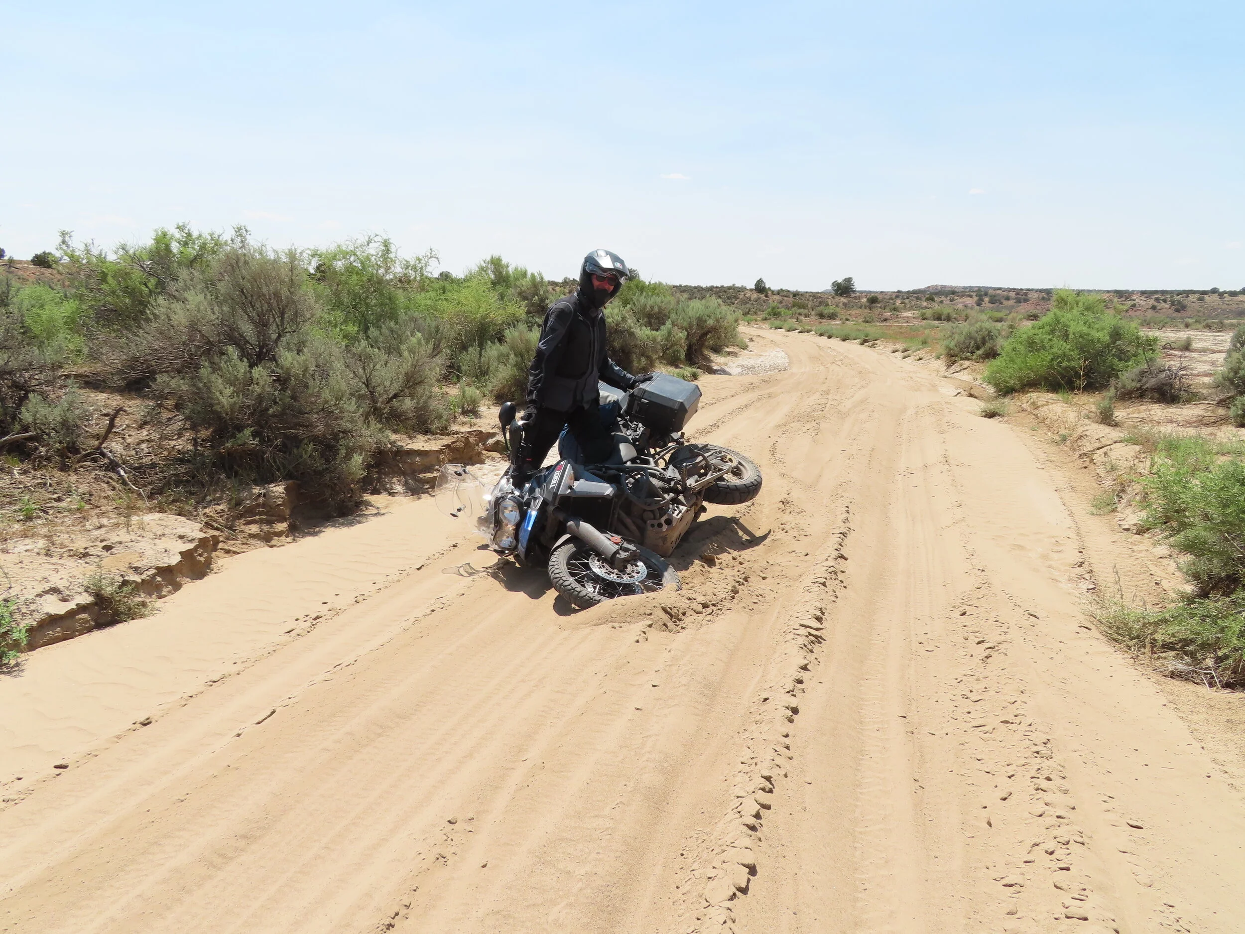
· Little bit of a late start. Hotel wasn’t serving breakfast and failed to mention at check-in. I saw a one off little Mexican place last night that had breakfast Tortas. It was also pretty close to our blue line route. GOOD GOD! Chorizo, sausage, egg, hash browns, cheese and ham. Hands down best Torta I’ve ever had (First breakfast torta too). On the road around 9:15
· Mid morning stop at an old abandoned homestead in a place called El Dado was pretty cool.
· Severe erosion from storm a couple of weeks prior on our route today. Guadalupe Rd had a few washouts. Albert posted vid of me crossing then having to dab to keep from dropping it.
· Encountered a bit of sand a few miles later. Tigger decided to take a closer look at the sand. I had to ride up a bit to be able to stop without falling over. When I made it back to Albert a truck approached from behind. Driver got out as we up righted the bike. Turns out that he was the owner of the ranch. Pretty cool guy. Was knowledgeable with the CDT and told us about the monsoon storm weeks ago and said no sand was there prior
· Gassed up in Cuba mid day headed thru Santa Fe Nat’l forest. First half was white gravel and lots of elevation change and incredible views. A couple of 10K passes here.
· It’s not really an adventure till something goes wrong. Today we found that adventure! Halfway between Cuba and Abiqui we were challenged with a steep rocky washed-out section (Maybe the same storm that went through El Dado?). Took an hour to go 1/10 of a mile. Lots of buddy action to get by this section (buddy action = your buddy helping keep your bike upright as we crawled up the hill) once passed that horrible section where I chunked out my rear tire and Albert toasted his clutch there were many more difficult sections for the following 40 to 50 miles. Exhaustion and thin air took its toll. Cattle in the dark? Yeah, there was that too. Not to exclude the muddy, knee deep section with cliffs on each side!! The hippie retreat was, you guessed it, down a road filled with river rocks. When we arrived (pretty late in the evening, I thought the host was not going to let us in. Once he saw the exhaustion on our faces I believe he changed his attitude. Or, it was the stern way I said “We’ve had a really rough day”.
· Woke up to one of the most amazing outdoor showers!


Panorama of awesome outdoor shower
Day 4
Abiquiu, NM
Chama, NM
Hooper, CO
Stats:
Miles: 202
Ride time: 7:06
Avg Speed: 50
Temp: 65° - 89°
Altitude: 6,292 min – 10,851 max
Notes:
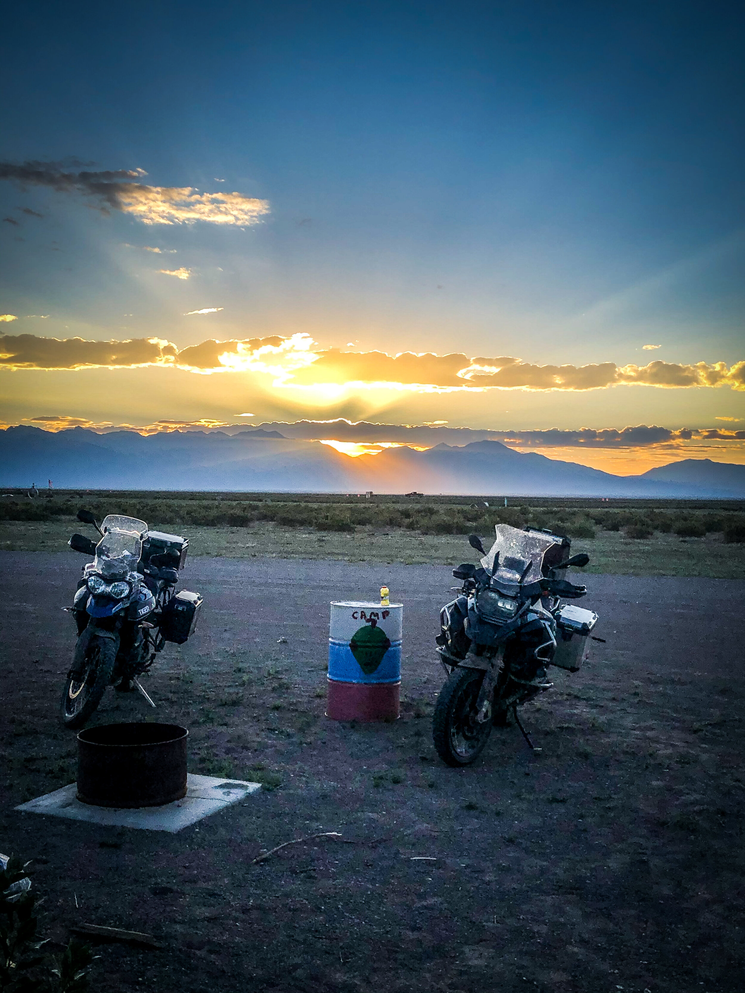
Lodging – UFO Watctower
Ride –
· Albert’s clutch is well done! We hope that overnight it would have cooled enough to give him the ability to get him to a repair shop. Closest Triumph shop is in Denver.
· Today we take the green route out and deviate off of it to find a Wal-Mart as I needed oil ( my oil low light came on last night in the nasty part between Cuba and Abiqui. Such low speeds and heat burned off a good bit of oil.
· Saw a place roasting green peppers, wanted them but when we came out of the store they were done and gone.
· Dinner was at the UFO camp site
· Ben joins the team after a day ride from Denver and then losing his pack on the trail which was found after 150+ miles of searching.
· Ben: Arrived with a headache from stress and effects of high altitude.
· Willey Nelson Made a guest appearance.
· Ben says that David swears that he saw 25 mice coming for our food that night at the UFO Watchtower. It was a dozen field mice bro!
· Saw our first shooting stars of the trip.
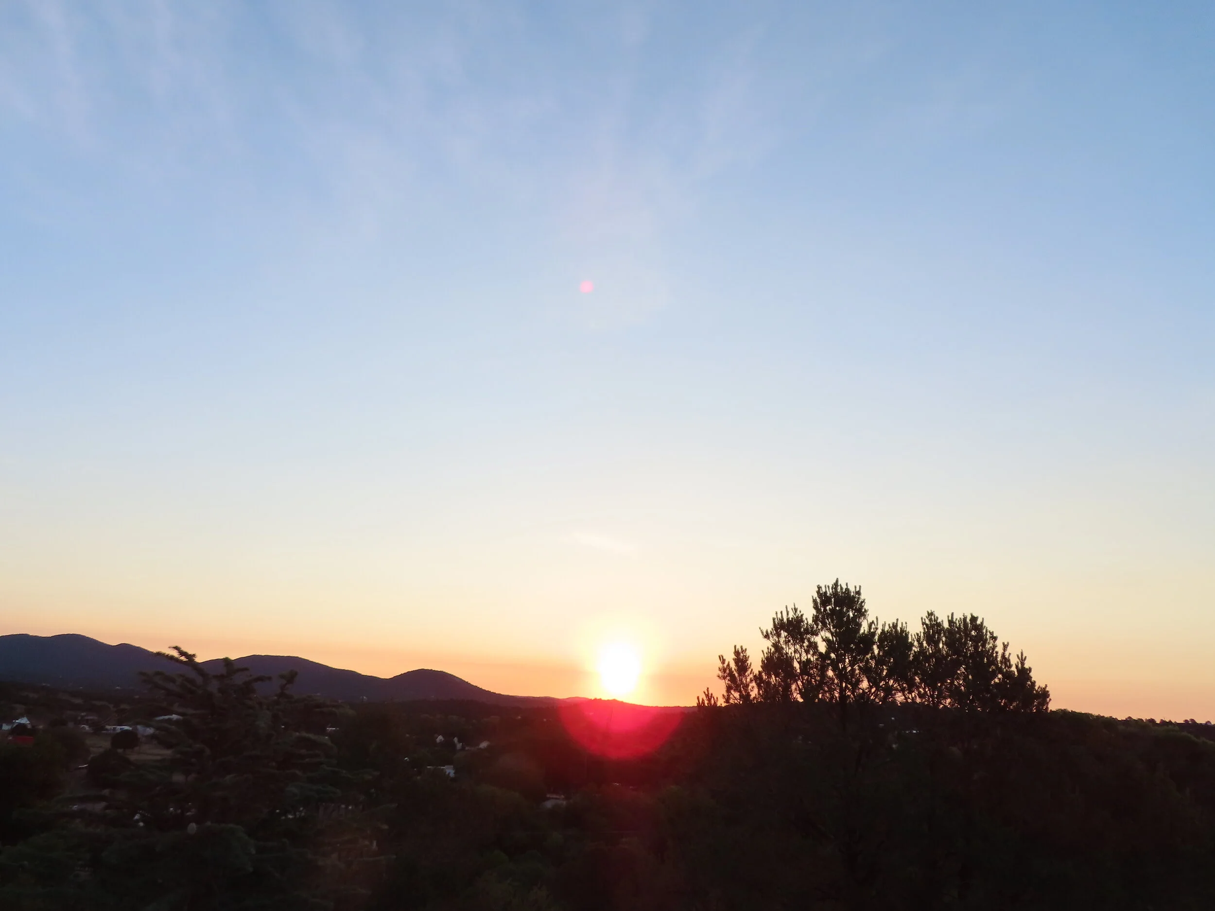
· Apparently, “Dave, yonder be the land of Mordor” is code for check out this completely bad ass moon rise.


Day 5
Hooper, CO
Sargents, CO
Keystone, CO
Stats:
Miles: 294
Ride time: 7:42
Avg Speed: 37
Temp: 56° - 88°
Altitude: 6,953 min – 11,499 max
Notes:
Lodging – AirBNB
Ride –
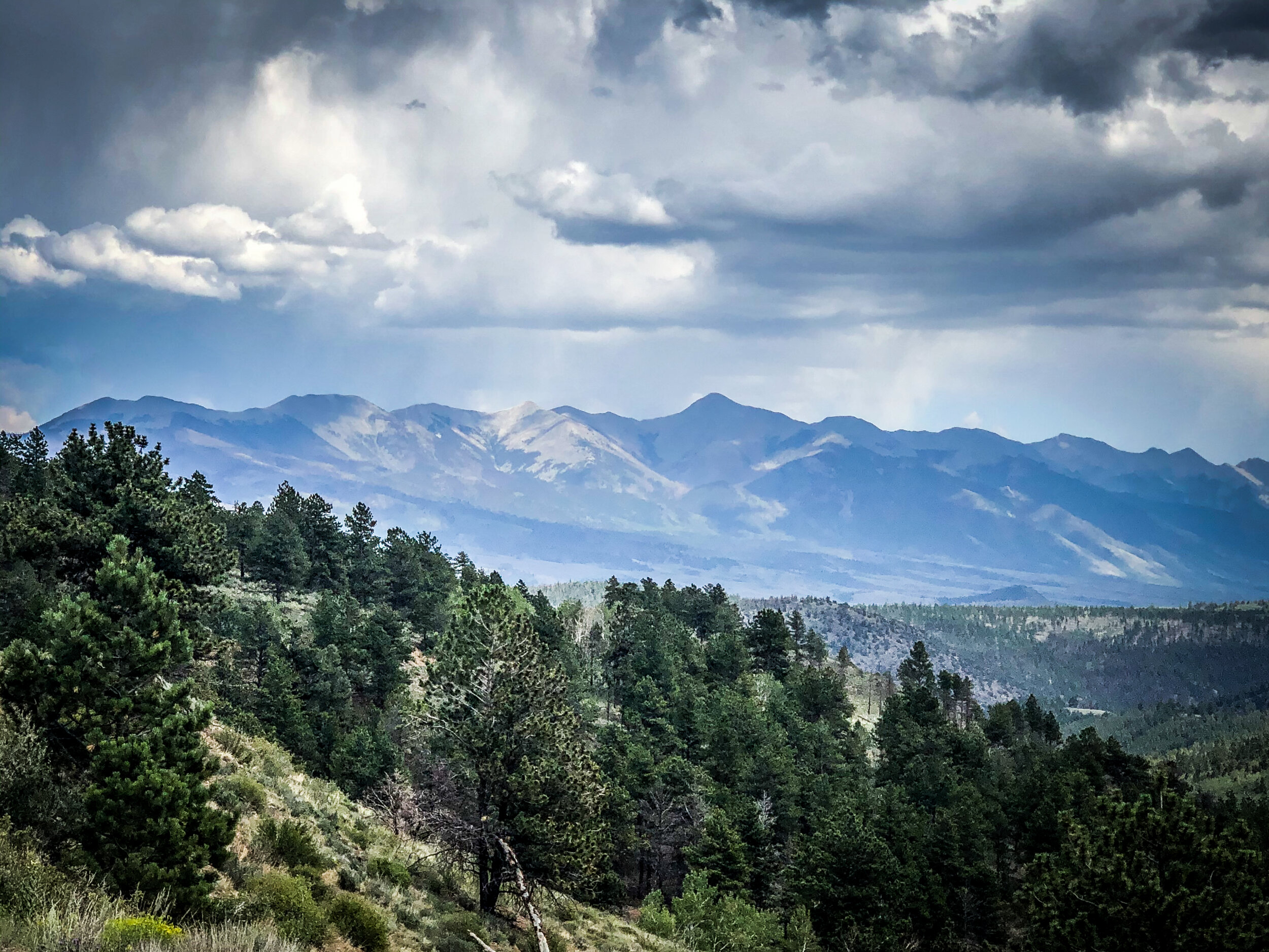
· Albert leaves the group for Denver to get a clutch replacement.
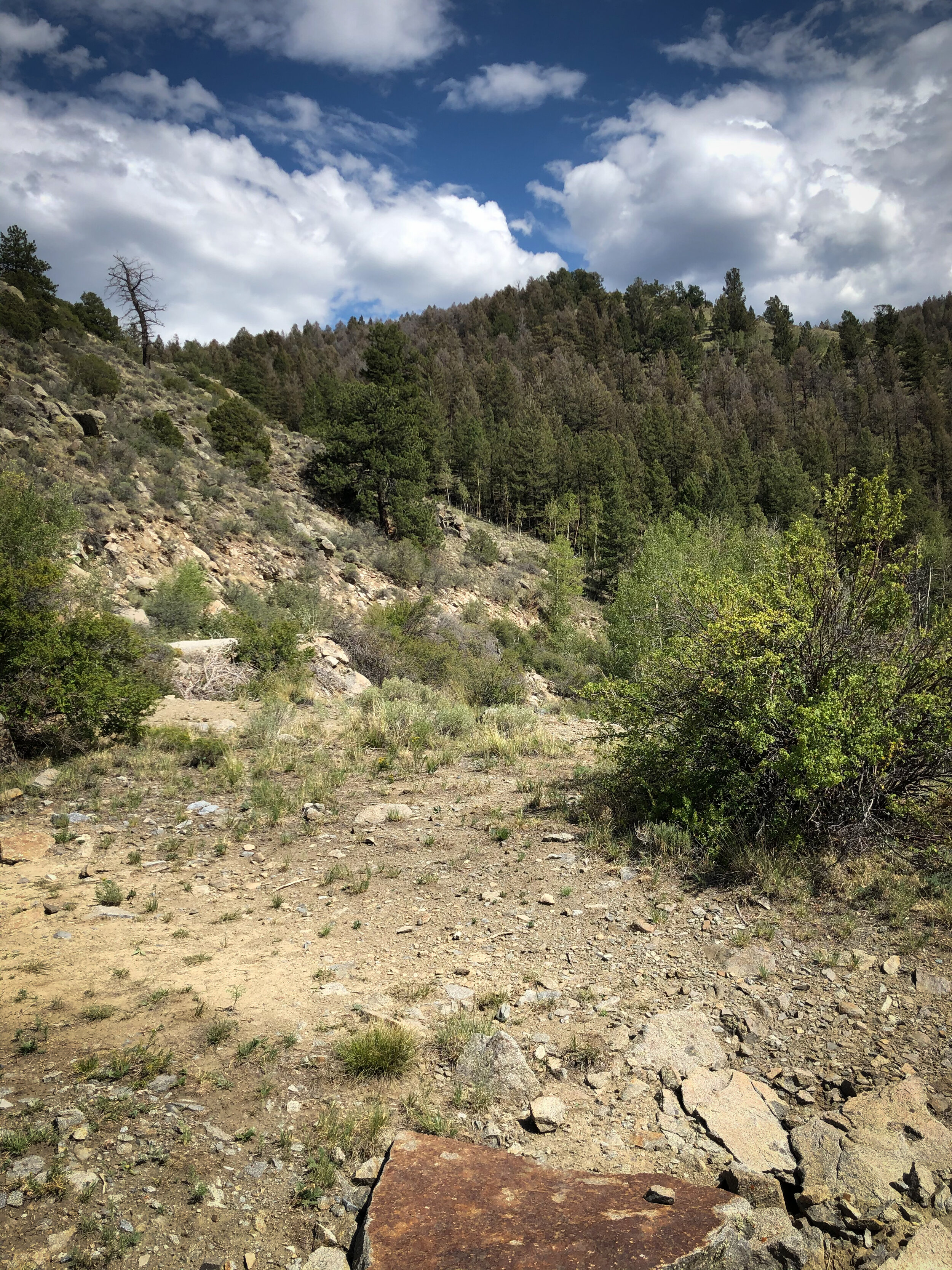
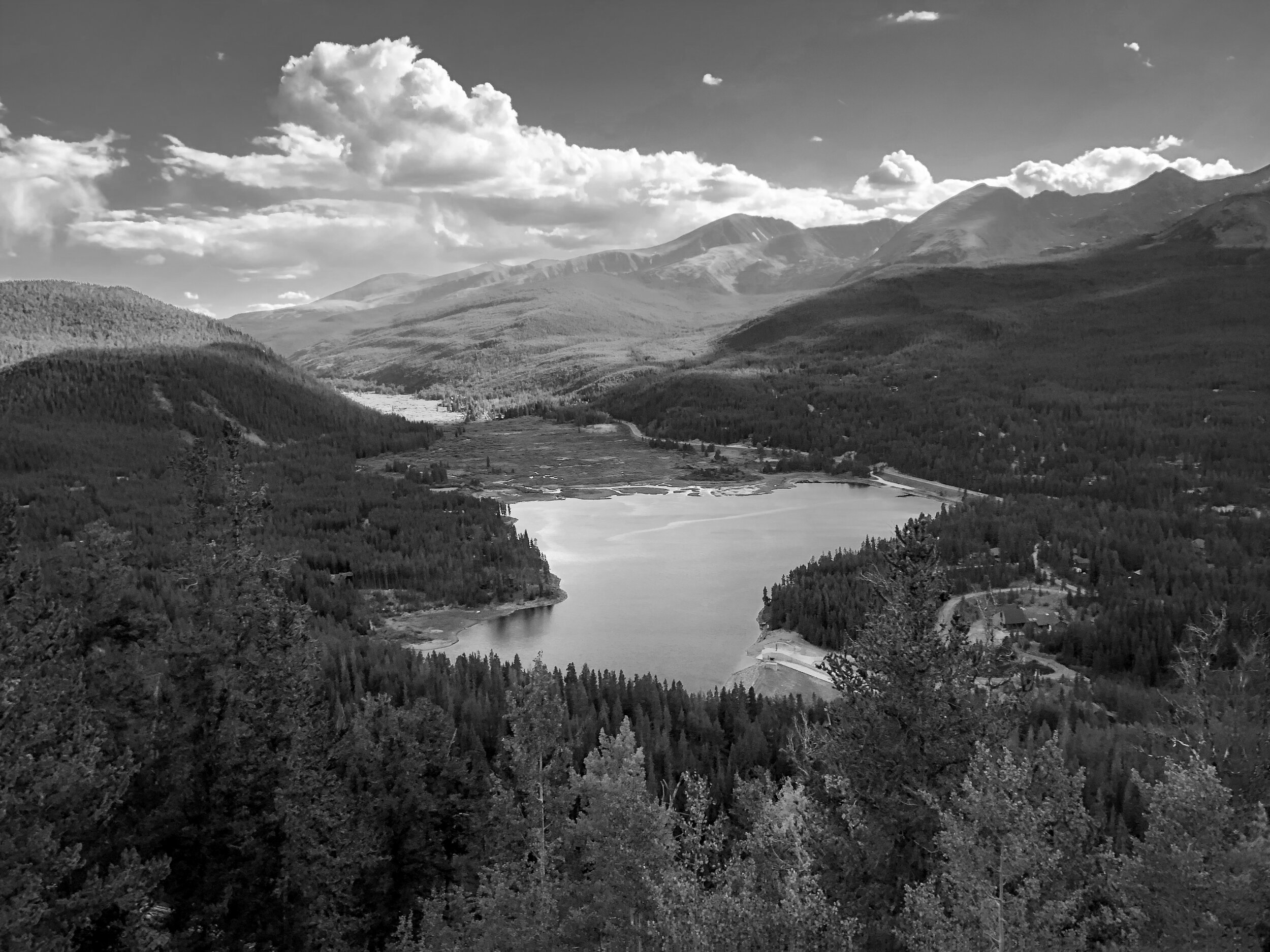
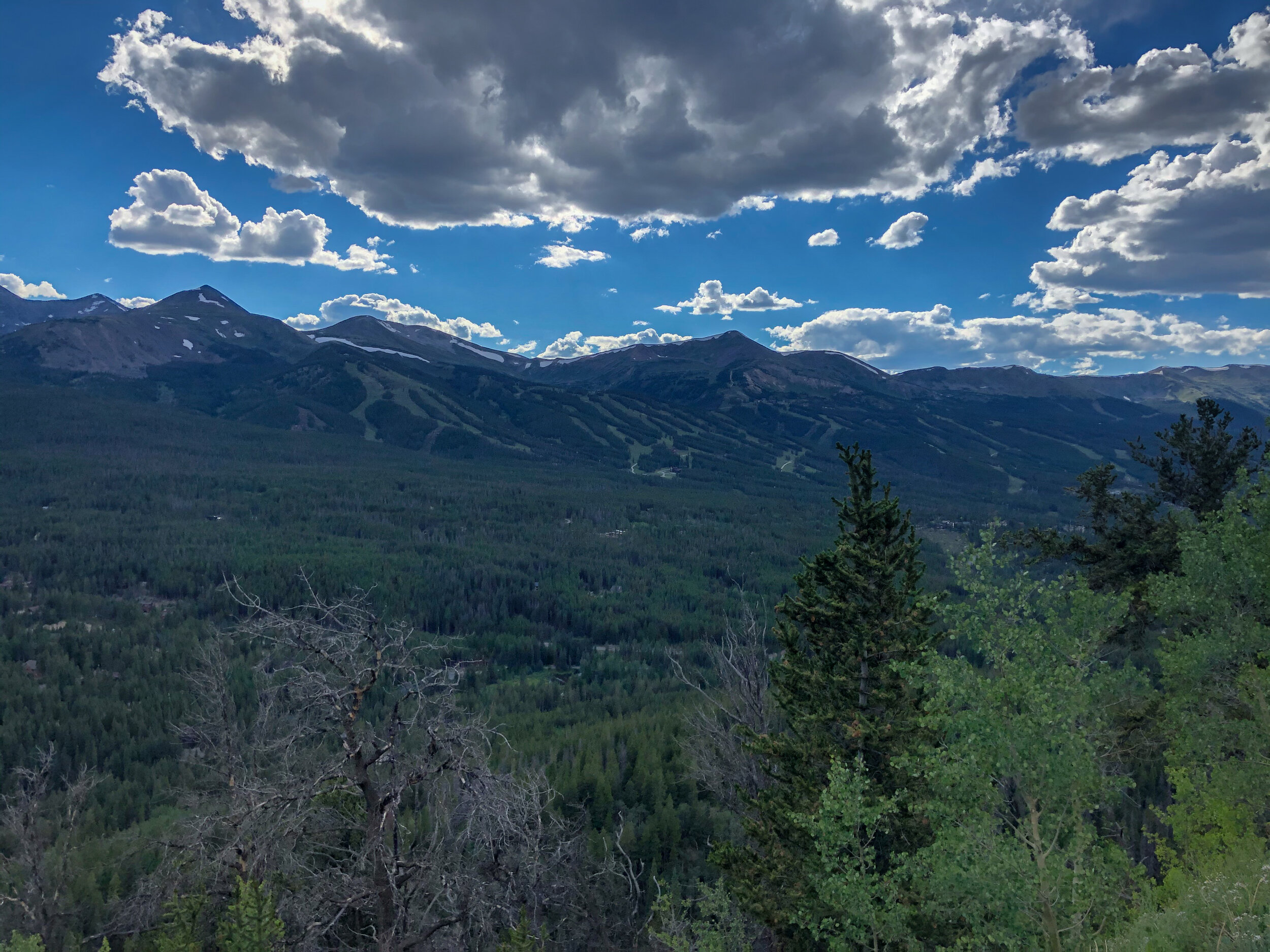
· Trails took us through the mountains of Breckenridge & Keystone. High altitude passes and scenic mountains.
· Kick ass water crossing between Salida and Hartsel. There was a rider on each side first one we encountered had just been thru it and the other looked to be contemplating. Ben ripped through it almost without stopping and I blindly followed never even putting a foot down. Would have loved to see the look and hear the other two guy’s conversation after they witnessed that.
· Totally missed the overlook in Salida called Tenderfoot Hill
· Wide prairie grasslands and pastures then into the mountains
· 360° views that were postcard worthy nearly every minute of the day
· Blasted past the Sapphire point overlook coming into town figuring we were hungry and thirsty after a busy day riding.
· Washed some clothes and got mex. and a margarita.
· Ben rode bitch to dinner on Mamba.
· LOL…..Keystone cops


Day 6:
Keystone, CO
Steamboat Springs, CO
Rawlins, WY
Stats:
Miles: 301
Ride time: 7:41
Avg Speed: 41
Temp: 52°-96°
Altitude: 8,224 min – 9,361 max
Notes:
Lodging – KOA Rawlins
Ride –
· Started the day with a “Dog Bowl” at the Haywood Café
· Downtown Silverthorne had us detour as there was a street fair going on.
· Mountain trails leading to some nice valleys and canyons until the trail became impassable
· Did a lot of back tracking to re-route but were unsuccessful and had to take an asphalt detour.
· I saw a huge ass stork beside the road. I may have some video.
· Finally found Aspen Alley (drone footage) after hearing David talk about it all day. Lol Also saw Lazy Ass Ranch
· Lunch at Steamboat at a burger place.
· Was in awe when we saw 3 Forks ranch. Jaw dropping after seeing the price for the retreat.
· Ben rode through an overlook road that no longer existed. I peed in the woods then caught up to him on the other side of the overlook loop that was no longer a loop
· Leg 2 was nice rolling hills up to some steppe type mountains.


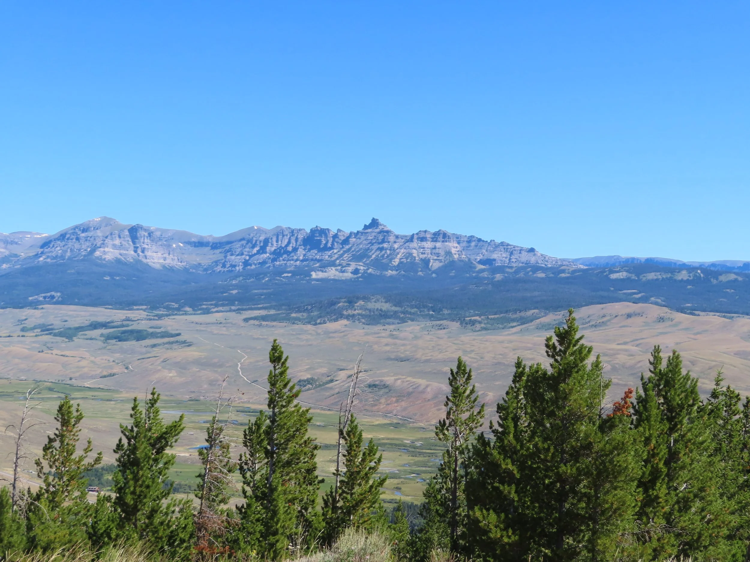
Day 7:
Rawlins, WY.
Lander, WY.
Pinedale, WY.
Stats:
Miles: 332
Ride time: 8.22
Avg Speed: 35
Temp: 58 - 90
Altitude: 6,549 - 8,162
Notes:
Lodging – AirBNB
Ride –
· Started the day with a bike swap until the trails thought it would be a good time for us to learn how to ride in the sand.
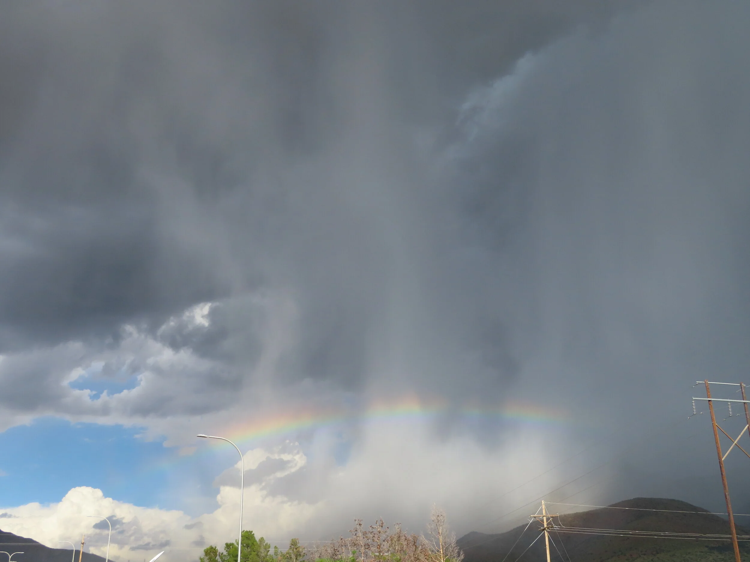
· A single leg ride mainly sierras. Much of the day threatened rain. We would see many of the dark clouds with hanging tendrils reaching for the ground but we never seemed to get wet or hit wet trails even though we rode toward them most of the day.
· Saw a lot of antelope and chased a baby fox off road.
· Came across a helicopter refueling on the ground that was working for the Bereau of Land Management and surveying horses. We saw them take off and later came across some of the wild horse. There was a large majestic black horse standing away from the herd, similar to the Black Stallion movie. I think I may have some vid on this.
· Ben ended with a hard route that was a bit rocky I took a more leisurely off-road ride.
· Good food and beer that night at Wind River Café. Ben and I put on a bit of a comedy routine and made a way with a few laughs from spectators and a couple of not so “To-Go” mugs.

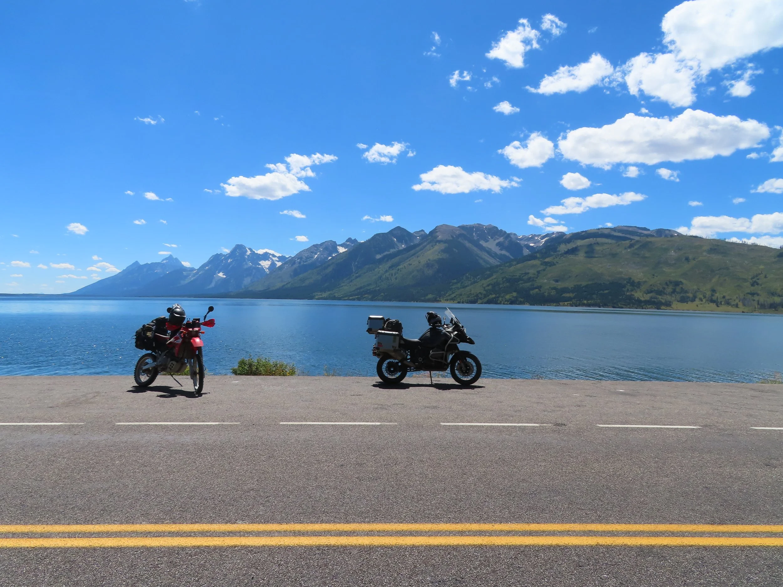
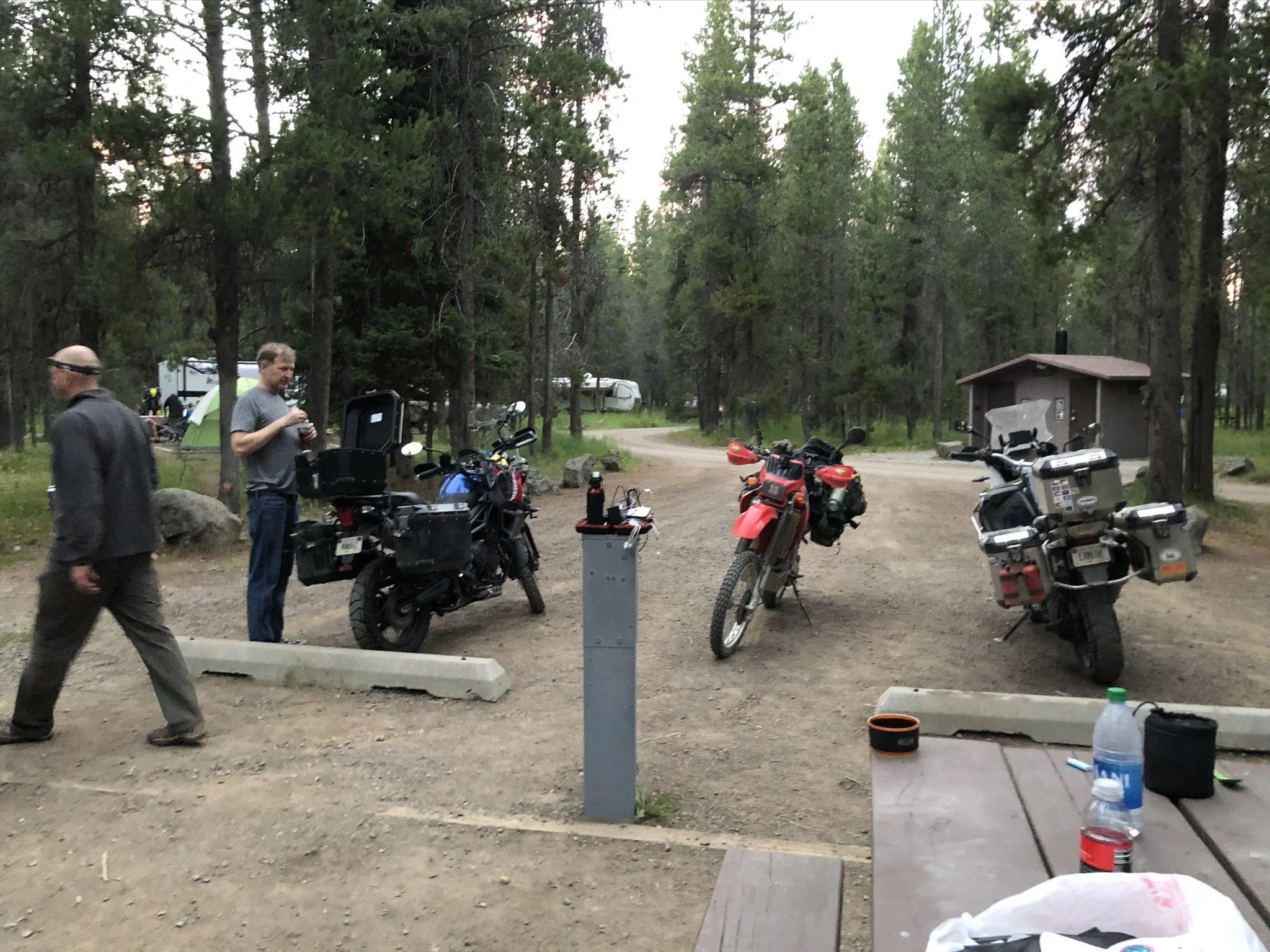
Day 8:
Pinedale, WY.
Tetons National Park
Island Park, ID
Stats:
Miles: 251
Ride time: 6.51
Avg Speed:
Temp:
Altitude:
Notes:
Lodging – Flat Rock Campground
Ride –
· The grand Tetons were bad ass. The rest of the day was mountain road and it was dusty as hell.
· Ben starting to worry about tire wear.
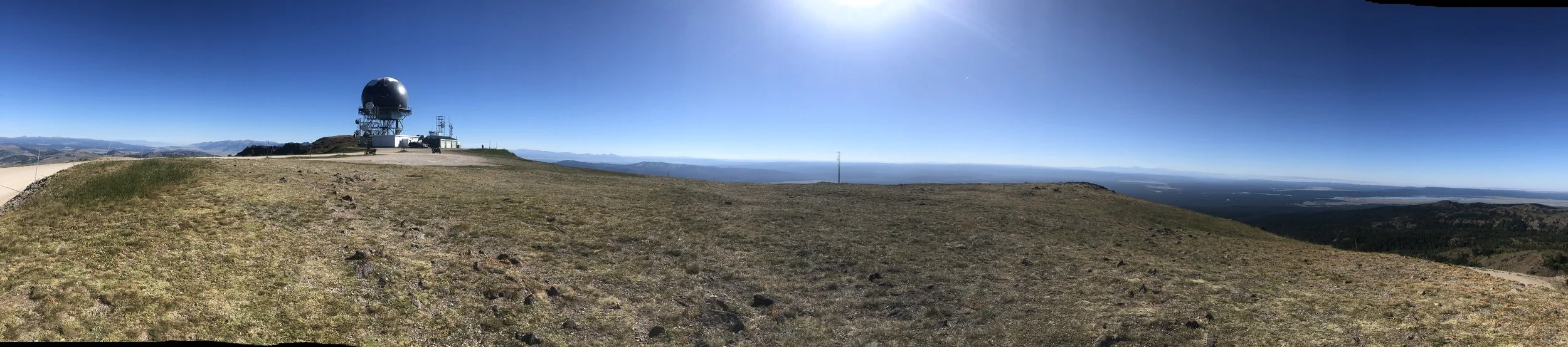
· Next time sparse camp at the top of the observatory on Sawtell Peak
· Albert rejoined us